
AFI Afiamalu, Western Samoa - Earthquake Result Viewer
| ||||||||||||||||||
| ||||||||||||||||||
| ||||||||||||||||||
|
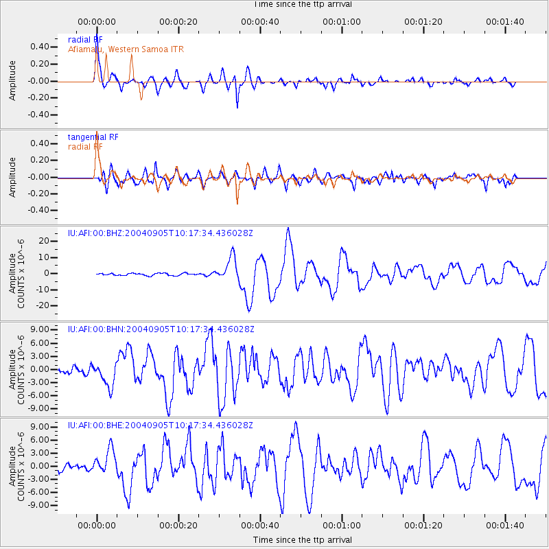
Signal To Noise
| Channel | StoN | STA | LTA |
| IU:AFI:00:BHN:20040905T10:17:34.436028Z | 4.029868 | 2.8418006E-6 | 7.0518456E-7 |
| IU:AFI:00:BHE:20040905T10:17:34.436028Z | 3.0756404 | 2.918533E-6 | 9.489188E-7 |
| IU:AFI:00:BHZ:20040905T10:17:34.436028Z | 11.087348 | 7.482177E-6 | 6.748392E-7 |
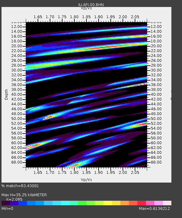
| Arrivals | |
| Ps | 9.2 SECOND |
| PpPs | 25 SECOND |
| PsPs/PpSs | 35 SECOND |

