You are here: Home > Network List > TA - USArray Transportable Network (new EarthScope stations) Stations List
> Station J05D Fort Rock, OR, USA > Earthquake Result Viewer
J05D Fort Rock, OR, USA - Earthquake Result Viewer

| Earthquake location: |
Mariana Islands |
| Earthquake latitude/longitude: |
13.8/144.4 |
| Earthquake time(UTC): |
2014/09/17 (260) 06:14:46 GMT |
| Earthquake Depth: |
137 km |
| Earthquake Magnitude: |
6.7 MWC, 7.1 MI |
| Earthquake Catalog/Contributor: |
NEIC PDE/NEIC COMCAT |
|
| Network: |
TA USArray Transportable Network (new EarthScope stations) |
| Station: |
J05D Fort Rock, OR, USA |
| Lat/Lon: |
43.28 N/121.23 W |
| Elevation: |
1541 m |
|
| Distance: |
83.8 deg |
| Az: |
47.085 deg |
| Baz: |
282.968 deg |
| Ray Param: |
0.045599386 |
| Estimated Moho Depth: |
23.25 km |
| Estimated Crust Vp/Vs: |
1.77 |
| Assumed Crust Vp: |
6.597 km/s |
| Estimated Crust Vs: |
3.717 km/s |
| Estimated Crust Poisson's Ratio: |
0.27 |
|
| Radial Match: |
87.704124 % |
| Radial Bump: |
400 |
| Transverse Match: |
83.4233 % |
| Transverse Bump: |
400 |
| SOD ConfigId: |
795072 |
| Insert Time: |
2014-10-01 07:57:01.954 +0000 |
| GWidth: |
2.5 |
| Max Bumps: |
400 |
| Tol: |
0.001 |
|
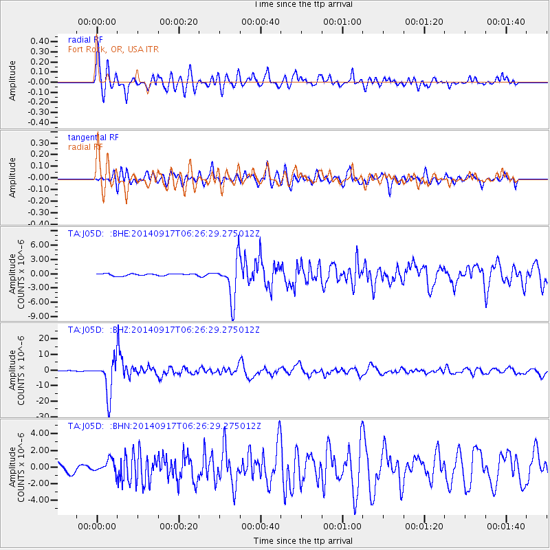
Signal To Noise
| Channel | StoN | STA | LTA |
| TA:J05D: :BHZ:20140917T06:26:29.275012Z | 58.269753 | 1.1433566E-5 | 1.9621785E-7 |
| TA:J05D: :BHN:20140917T06:26:29.275012Z | 1.5044694 | 8.305064E-7 | 5.5202617E-7 |
| TA:J05D: :BHE:20140917T06:26:29.275012Z | 21.047922 | 4.4077387E-6 | 2.0941444E-7 |
| Arrivals |
| Ps | 2.8 SECOND |
| PpPs | 9.5 SECOND |
| PsPs/PpSs | 12 SECOND |


