You are here: Home > Network List > TA - USArray Transportable Network (new EarthScope stations) Stations List
> Station M04C Macdoel, CA, USA > Earthquake Result Viewer
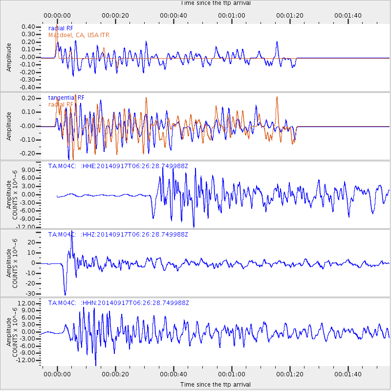
M04C Macdoel, CA, USA - Earthquake Result Viewer
*The percent match for this event was below the threshold and hence no stack was calculated.
| Earthquake location: |
Mariana Islands |
| Earthquake latitude/longitude: |
13.8/144.4 |
| Earthquake time(UTC): |
2014/09/17 (260) 06:14:46 GMT |
| Earthquake Depth: |
137 km |
| Earthquake Magnitude: |
6.7 MWC, 7.1 MI |
| Earthquake Catalog/Contributor: |
NEIC PDE/NEIC COMCAT |
|
| Network: |
TA USArray Transportable Network (new EarthScope stations) |
| Station: |
M04C Macdoel, CA, USA |
| Lat/Lon: |
41.78 N/121.84 W |
| Elevation: |
1391 m |
|
| Distance: |
83.7 deg |
| Az: |
48.657 deg |
| Baz: |
282.731 deg |
| Ray Param: |
$rayparam |
*The percent match for this event was below the threshold and hence was not used in the summary stack. |
|
| Radial Match: |
74.39889 % |
| Radial Bump: |
400 |
| Transverse Match: |
73.10231 % |
| Transverse Bump: |
400 |
| SOD ConfigId: |
795072 |
| Insert Time: |
2014-10-01 07:57:31.892 +0000 |
| GWidth: |
2.5 |
| Max Bumps: |
400 |
| Tol: |
0.001 |
|
Signal To Noise
| Channel | StoN | STA | LTA |
| TA:M04C: :HHZ:20140917T06:26:28.749988Z | 50.172447 | 1.21041185E-5 | 2.412503E-7 |
| TA:M04C: :HHN:20140917T06:26:28.749988Z | 3.3974895 | 1.4947312E-6 | 4.3995166E-7 |
| TA:M04C: :HHE:20140917T06:26:28.749988Z | 10.52246 | 3.1602142E-6 | 3.0033038E-7 |
| Arrivals |
| Ps | |
| PpPs | |
| PsPs/PpSs | |


