You are here: Home > Network List > CI - Caltech Regional Seismic Network Stations List
> Station MPP McPhearson Peak > Earthquake Result Viewer
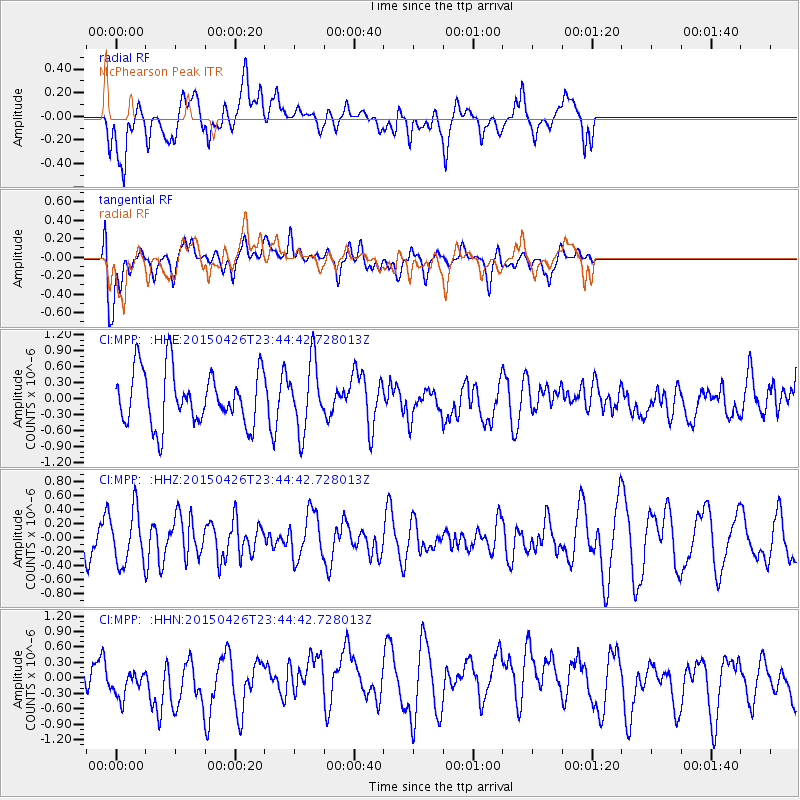
MPP McPhearson Peak - Earthquake Result Viewer
*The percent match for this event was below the threshold and hence no stack was calculated.
| Earthquake location: |
Near Coast Of Northern Peru |
| Earthquake latitude/longitude: |
-8.3/-79.8 |
| Earthquake time(UTC): |
2015/04/26 (116) 23:35:29 GMT |
| Earthquake Depth: |
22 km |
| Earthquake Magnitude: |
5.6 MWW, 5.6 MWB, 5.7 MWC |
| Earthquake Catalog/Contributor: |
NEIC PDE/NEIC COMCAT |
|
| Network: |
CI Caltech Regional Seismic Network |
| Station: |
MPP McPhearson Peak |
| Lat/Lon: |
34.89 N/119.81 W |
| Elevation: |
1739 m |
|
| Distance: |
57.2 deg |
| Az: |
321.057 deg |
| Baz: |
130.828 deg |
| Ray Param: |
$rayparam |
*The percent match for this event was below the threshold and hence was not used in the summary stack. |
|
| Radial Match: |
55.803112 % |
| Radial Bump: |
400 |
| Transverse Match: |
54.4464 % |
| Transverse Bump: |
400 |
| SOD ConfigId: |
7422571 |
| Insert Time: |
2019-04-18 13:09:58.431 +0000 |
| GWidth: |
2.5 |
| Max Bumps: |
400 |
| Tol: |
0.001 |
|
Signal To Noise
| Channel | StoN | STA | LTA |
| CI:MPP: :HHZ:20150426T23:44:42.728013Z | 1.1609361 | 3.7561665E-7 | 3.2354635E-7 |
| CI:MPP: :HHN:20150426T23:44:42.728013Z | 0.90902907 | 3.1346917E-7 | 3.4483955E-7 |
| CI:MPP: :HHE:20150426T23:44:42.728013Z | 1.2577562 | 6.465493E-7 | 5.140498E-7 |
| Arrivals |
| Ps | |
| PpPs | |
| PsPs/PpSs | |


