You are here: Home > Network List > GT - Global Telemetered Seismograph Network (USAF/USGS) Stations List
> Station PLCA Paso Flores, Argentina > Earthquake Result Viewer
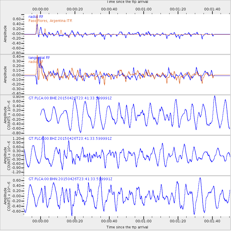
PLCA Paso Flores, Argentina - Earthquake Result Viewer
*The percent match for this event was below the threshold and hence no stack was calculated.
| Earthquake location: |
Near Coast Of Northern Peru |
| Earthquake latitude/longitude: |
-8.3/-79.8 |
| Earthquake time(UTC): |
2015/04/26 (116) 23:35:29 GMT |
| Earthquake Depth: |
22 km |
| Earthquake Magnitude: |
5.6 MWW, 5.6 MWB, 5.7 MWC |
| Earthquake Catalog/Contributor: |
NEIC PDE/NEIC COMCAT |
|
| Network: |
GT Global Telemetered Seismograph Network (USAF/USGS) |
| Station: |
PLCA Paso Flores, Argentina |
| Lat/Lon: |
40.73 S/70.55 W |
| Elevation: |
1050 m |
|
| Distance: |
33.3 deg |
| Az: |
167.137 deg |
| Baz: |
343.147 deg |
| Ray Param: |
$rayparam |
*The percent match for this event was below the threshold and hence was not used in the summary stack. |
|
| Radial Match: |
63.286156 % |
| Radial Bump: |
400 |
| Transverse Match: |
60.05925 % |
| Transverse Bump: |
400 |
| SOD ConfigId: |
7422571 |
| Insert Time: |
2019-04-18 13:11:05.355 +0000 |
| GWidth: |
2.5 |
| Max Bumps: |
400 |
| Tol: |
0.001 |
|
Signal To Noise
| Channel | StoN | STA | LTA |
| GT:PLCA:00:BHZ:20150426T23:41:33.599991Z | 1.5625833 | 5.88725E-7 | 3.7676392E-7 |
| GT:PLCA:00:BHN:20150426T23:41:33.599991Z | 0.6262189 | 2.522355E-7 | 4.0279127E-7 |
| GT:PLCA:00:BHE:20150426T23:41:33.599991Z | 1.32243 | 4.79244E-7 | 3.623965E-7 |
| Arrivals |
| Ps | |
| PpPs | |
| PsPs/PpSs | |


