You are here: Home > Network List > UW - Pacific Northwest Regional Seismic Network Stations List
> Station UMAT Pilot Rock, OR, USA > Earthquake Result Viewer
UMAT Pilot Rock, OR, USA - Earthquake Result Viewer

| Earthquake location: |
Mariana Islands |
| Earthquake latitude/longitude: |
13.8/144.4 |
| Earthquake time(UTC): |
2014/09/17 (260) 06:14:46 GMT |
| Earthquake Depth: |
137 km |
| Earthquake Magnitude: |
6.7 MWC, 7.1 MI |
| Earthquake Catalog/Contributor: |
NEIC PDE/NEIC COMCAT |
|
| Network: |
UW Pacific Northwest Regional Seismic Network |
| Station: |
UMAT Pilot Rock, OR, USA |
| Lat/Lon: |
45.29 N/118.96 W |
| Elevation: |
1318 m |
|
| Distance: |
85.0 deg |
| Az: |
44.74 deg |
| Baz: |
284.322 deg |
| Ray Param: |
0.0448053 |
| Estimated Moho Depth: |
24.0 km |
| Estimated Crust Vp/Vs: |
1.81 |
| Assumed Crust Vp: |
6.571 km/s |
| Estimated Crust Vs: |
3.64 km/s |
| Estimated Crust Poisson's Ratio: |
0.28 |
|
| Radial Match: |
92.451355 % |
| Radial Bump: |
400 |
| Transverse Match: |
80.28518 % |
| Transverse Bump: |
400 |
| SOD ConfigId: |
795072 |
| Insert Time: |
2014-10-01 08:16:24.299 +0000 |
| GWidth: |
2.5 |
| Max Bumps: |
400 |
| Tol: |
0.001 |
|
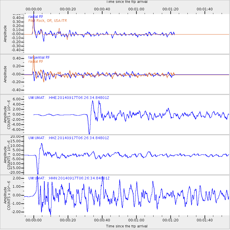
Signal To Noise
| Channel | StoN | STA | LTA |
| UW:UMAT: :HHZ:20140917T06:26:34.84801Z | 62.934364 | 9.372464E-6 | 1.4892443E-7 |
| UW:UMAT: :HHN:20140917T06:26:34.84801Z | 5.8351693 | 1.0155891E-6 | 1.740462E-7 |
| UW:UMAT: :HHE:20140917T06:26:34.84801Z | 23.104902 | 3.5702953E-6 | 1.5452545E-7 |
| Arrivals |
| Ps | 3.0 SECOND |
| PpPs | 10.0 SECOND |
| PsPs/PpSs | 13 SECOND |


