
AFI Afiamalu, Western Samoa - Earthquake Result Viewer
| ||||||||||||||||||
| ||||||||||||||||||
| ||||||||||||||||||
|
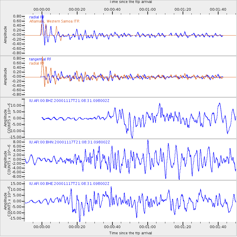
Signal To Noise
| Channel | StoN | STA | LTA |
| IU:AFI:00:BHN:20001117T21:08:31.098002Z | 0.36335996 | 4.6539148E-7 | 1.2808001E-6 |
| IU:AFI:00:BHE:20001117T21:08:31.098002Z | 1.6649829 | 1.4958396E-6 | 8.984113E-7 |
| IU:AFI:00:BHZ:20001117T21:08:31.098002Z | 1.5832609 | 9.879053E-7 | 6.239688E-7 |
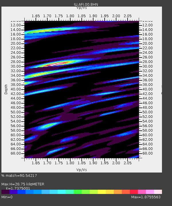
| Arrivals | |
| Ps | 5.2 SECOND |
| PpPs | 18 SECOND |
| PsPs/PpSs | 23 SECOND |

