AFI Afiamalu, Western Samoa - Earthquake Result Viewer
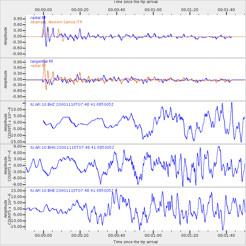
Earthquake location: New Ireland Region, P.N.G.
Earthquake latitude/longitude: -5.2/153.1
Earthquake time(UTC): 2000/11/16 (321) 07:42:16 GMT
Earthquake Depth: 30 km
Earthquake Magnitude: 6.2 MB, 7.8 MS, 7.6 MW, 7.3 ME
Earthquake Catalog/Contributor: WHDF/NEIC
Network: IU Global Seismograph Network (GSN - IRIS/USGS)
Station: AFI Afiamalu, Western Samoa
Lat/Lon: 13.91 S/171.78 W
Elevation: 706 m
Distance: 35.6 deg
Az: 106.542 deg
Baz: 280.54 deg
Ray Param: 0.077059
Estimated Moho Depth: 27.75 km
Estimated Crust Vp/Vs: 1.81
Assumed Crust Vp: 4.24 km/s
Estimated Crust Vs: 2.343 km/s
Estimated Crust Poisson's Ratio: 0.28
Radial Match: 86.40851 %
Radial Bump: 400
Transverse Match: 63.90769 %
Transverse Bump: 400
SOD ConfigId: 3744
Insert Time: 2010-03-02 01:44:38.417 +0000
GWidth: 2.5
Max Bumps: 400
Tol: 0.001

Signal To Noise

ChannelStoNSTALTA
IU:AFI:10:BHN:20001116T07:48:41.685005Z0.876504542.5945674E-62.9601301E-6
IU:AFI:10:BHE:20001116T07:48:41.685005Z1.18826431.9697E-61.6576279E-6
IU:AFI:10:BHZ:20001116T07:48:41.685005Z1.28655023.0431233E-62.3653358E-6
Arrivals
Ps5.5 SECOND
PpPs18 SECOND
PsPs/PpSs23 SECOND