AFI Afiamalu, Western Samoa - Earthquake Result Viewer
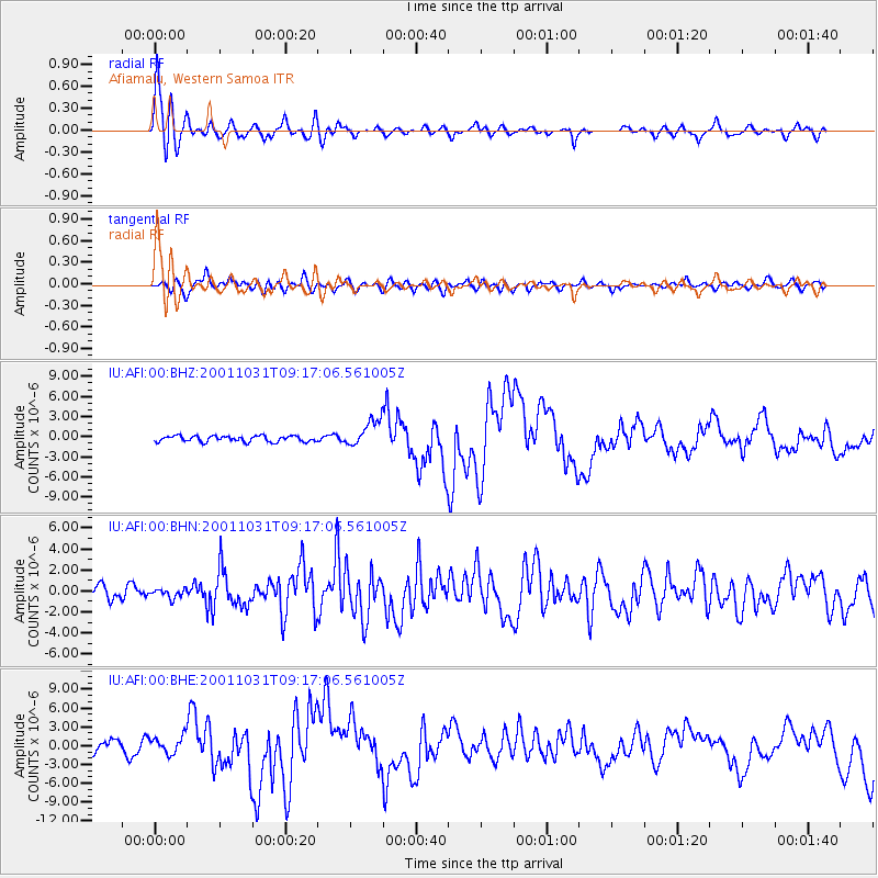
Earthquake location: New Britain Region, P.N.G.
Earthquake latitude/longitude: -5.9/150.2
Earthquake time(UTC): 2001/10/31 (304) 09:10:20 GMT
Earthquake Depth: 33 km
Earthquake Magnitude: 5.9 MB, 6.9 MS, 6.9 MW, 6.9 MW
Earthquake Catalog/Contributor: WHDF/NEIC
Network: IU Global Seismograph Network (GSN - IRIS/USGS)
Station: AFI Afiamalu, Western Samoa
Lat/Lon: 13.91 S/171.78 W
Elevation: 706 m
Distance: 38.2 deg
Az: 104.916 deg
Baz: 278.155 deg
Ray Param: 0.0756081
Estimated Moho Depth: 36.0 km
Estimated Crust Vp/Vs: 1.98
Assumed Crust Vp: 4.24 km/s
Estimated Crust Vs: 2.141 km/s
Estimated Crust Poisson's Ratio: 0.33
Radial Match: 91.270004 %
Radial Bump: 400
Transverse Match: 66.79638 %
Transverse Bump: 400
SOD ConfigId: 20082
Insert Time: 2010-03-02 01:44:39.679 +0000
GWidth: 2.5
Max Bumps: 400
Tol: 0.001

Signal To Noise

ChannelStoNSTALTA
IU:AFI:00:BHN:20011031T09:17:06.561005Z0.600292864.1551465E-76.921866E-7
IU:AFI:00:BHE:20011031T09:17:06.561005Z1.80013741.3791081E-67.6611263E-7
IU:AFI:00:BHZ:20011031T09:17:06.561005Z4.4735131.953783E-64.3674467E-7
Arrivals
Ps8.5 SECOND
PpPs25 SECOND
PsPs/PpSs33 SECOND