You are here: Home > Network List > AV - Alaska Volcano Observatory Stations List
> Station MAPS Pakushin Southeast, Makushin Volcano, Alaska > Earthquake Result Viewer
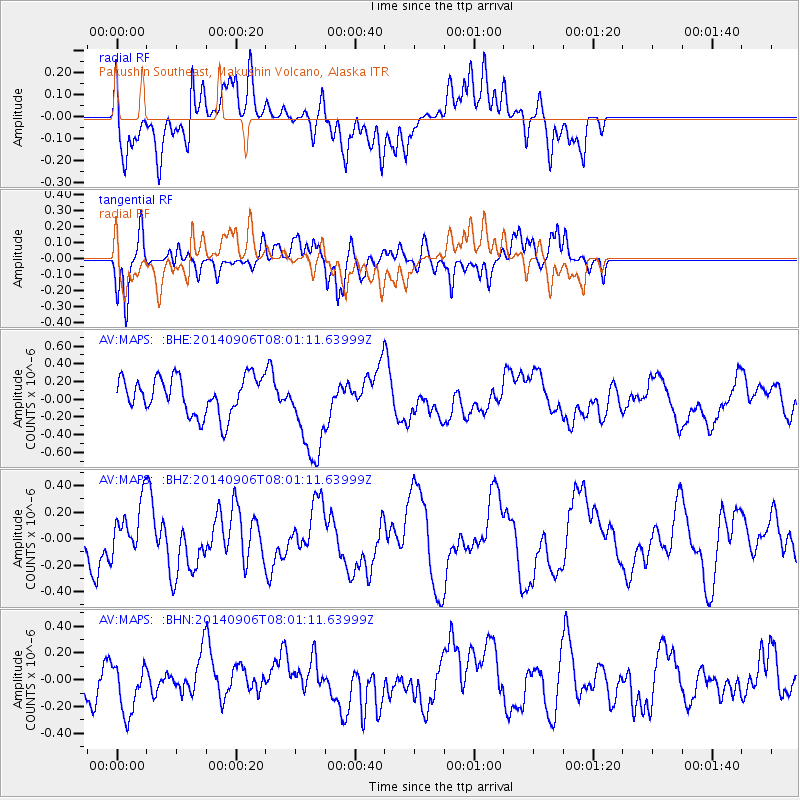
MAPS Pakushin Southeast, Makushin Volcano, Alaska - Earthquake Result Viewer
*The percent match for this event was below the threshold and hence no stack was calculated.
| Earthquake location: |
Easter Island Region |
| Earthquake latitude/longitude: |
-26.8/-114.5 |
| Earthquake time(UTC): |
2014/09/06 (249) 07:48:33 GMT |
| Earthquake Depth: |
10 km |
| Earthquake Magnitude: |
5.9 MWW, 5.8 MWC |
| Earthquake Catalog/Contributor: |
NEIC PDE/NEIC COMCAT |
|
| Network: |
AV Alaska Volcano Observatory |
| Station: |
MAPS Pakushin Southeast, Makushin Volcano, Alaska |
| Lat/Lon: |
53.81 N/166.94 W |
| Elevation: |
333 m |
|
| Distance: |
92.2 deg |
| Az: |
331.923 deg |
| Baz: |
134.804 deg |
| Ray Param: |
$rayparam |
*The percent match for this event was below the threshold and hence was not used in the summary stack. |
|
| Radial Match: |
51.27438 % |
| Radial Bump: |
400 |
| Transverse Match: |
49.68275 % |
| Transverse Bump: |
305 |
| SOD ConfigId: |
795072 |
| Insert Time: |
2014-10-03 11:44:05.412 +0000 |
| GWidth: |
2.5 |
| Max Bumps: |
400 |
| Tol: |
0.001 |
|
Signal To Noise
| Channel | StoN | STA | LTA |
| AV:MAPS: :BHZ:20140906T08:01:11.63999Z | 0.8985827 | 1.9963367E-7 | 2.2216504E-7 |
| AV:MAPS: :BHN:20140906T08:01:11.63999Z | 1.2327961 | 1.980667E-7 | 1.6066463E-7 |
| AV:MAPS: :BHE:20140906T08:01:11.63999Z | 2.469754 | 5.1825157E-7 | 2.0983933E-7 |
| Arrivals |
| Ps | |
| PpPs | |
| PsPs/PpSs | |


