You are here: Home > Network List > TA - USArray Transportable Network (new EarthScope stations) Stations List
> Station K63A Dunstable, MA, USA > Earthquake Result Viewer
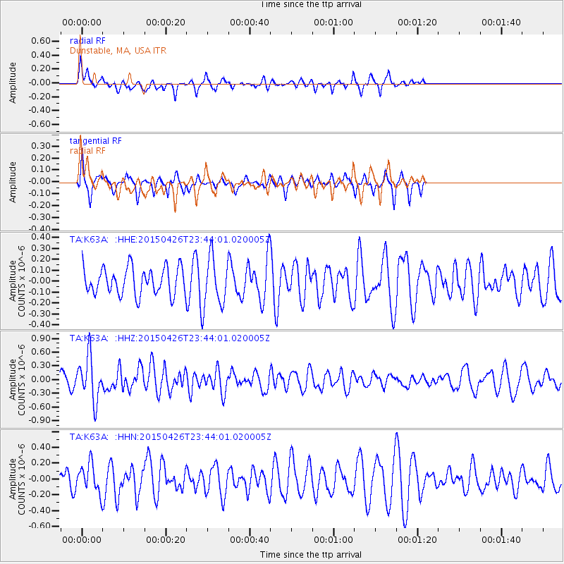
K63A Dunstable, MA, USA - Earthquake Result Viewer
*The percent match for this event was below the threshold and hence no stack was calculated.
| Earthquake location: |
Near Coast Of Northern Peru |
| Earthquake latitude/longitude: |
-8.3/-79.8 |
| Earthquake time(UTC): |
2015/04/26 (116) 23:35:29 GMT |
| Earthquake Depth: |
22 km |
| Earthquake Magnitude: |
5.6 MWW, 5.6 MWB, 5.7 MWC |
| Earthquake Catalog/Contributor: |
NEIC PDE/NEIC COMCAT |
|
| Network: |
TA USArray Transportable Network (new EarthScope stations) |
| Station: |
K63A Dunstable, MA, USA |
| Lat/Lon: |
42.69 N/71.53 W |
| Elevation: |
68 m |
|
| Distance: |
51.3 deg |
| Az: |
7.823 deg |
| Baz: |
190.527 deg |
| Ray Param: |
$rayparam |
*The percent match for this event was below the threshold and hence was not used in the summary stack. |
|
| Radial Match: |
59.025063 % |
| Radial Bump: |
289 |
| Transverse Match: |
60.922565 % |
| Transverse Bump: |
237 |
| SOD ConfigId: |
7422571 |
| Insert Time: |
2019-04-18 13:14:46.799 +0000 |
| GWidth: |
2.5 |
| Max Bumps: |
400 |
| Tol: |
0.001 |
|
Signal To Noise
| Channel | StoN | STA | LTA |
| TA:K63A: :HHZ:20150426T23:44:01.020005Z | 2.771308 | 4.92217E-7 | 1.776118E-7 |
| TA:K63A: :HHN:20150426T23:44:01.020005Z | 1.4837781 | 1.9120655E-7 | 1.2886466E-7 |
| TA:K63A: :HHE:20150426T23:44:01.020005Z | 1.6976882 | 2.1126901E-7 | 1.2444512E-7 |
| Arrivals |
| Ps | |
| PpPs | |
| PsPs/PpSs | |


