You are here: Home > Network List > TA - USArray Transportable Network (new EarthScope stations) Stations List
> Station M57A Sunshine Farm, Cogan Station, PA, USA > Earthquake Result Viewer
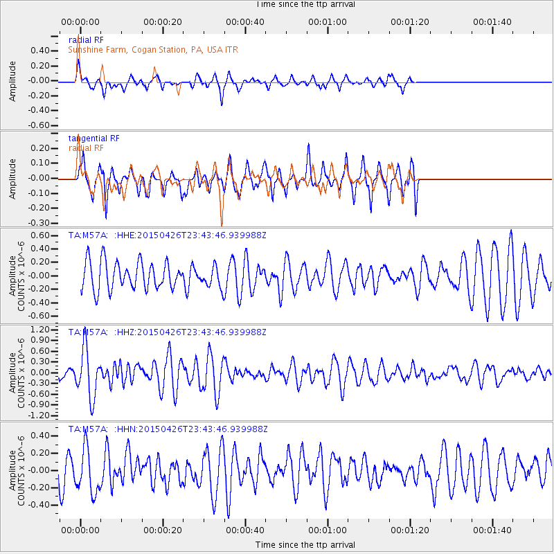
M57A Sunshine Farm, Cogan Station, PA, USA - Earthquake Result Viewer
*The percent match for this event was below the threshold and hence no stack was calculated.
| Earthquake location: |
Near Coast Of Northern Peru |
| Earthquake latitude/longitude: |
-8.3/-79.8 |
| Earthquake time(UTC): |
2015/04/26 (116) 23:35:29 GMT |
| Earthquake Depth: |
22 km |
| Earthquake Magnitude: |
5.6 MWW, 5.6 MWB, 5.7 MWC |
| Earthquake Catalog/Contributor: |
NEIC PDE/NEIC COMCAT |
|
| Network: |
TA USArray Transportable Network (new EarthScope stations) |
| Station: |
M57A Sunshine Farm, Cogan Station, PA, USA |
| Lat/Lon: |
41.34 N/77.13 W |
| Elevation: |
319 m |
|
| Distance: |
49.5 deg |
| Az: |
2.661 deg |
| Baz: |
183.498 deg |
| Ray Param: |
$rayparam |
*The percent match for this event was below the threshold and hence was not used in the summary stack. |
|
| Radial Match: |
64.34163 % |
| Radial Bump: |
400 |
| Transverse Match: |
76.74219 % |
| Transverse Bump: |
371 |
| SOD ConfigId: |
7422571 |
| Insert Time: |
2019-04-18 13:14:59.089 +0000 |
| GWidth: |
2.5 |
| Max Bumps: |
400 |
| Tol: |
0.001 |
|
Signal To Noise
| Channel | StoN | STA | LTA |
| TA:M57A: :HHZ:20150426T23:43:46.939988Z | 4.47204 | 6.9083626E-7 | 1.54479E-7 |
| TA:M57A: :HHN:20150426T23:43:46.939988Z | 1.2700384 | 2.6815465E-7 | 2.1113901E-7 |
| TA:M57A: :HHE:20150426T23:43:46.939988Z | 0.9318377 | 1.8824291E-7 | 2.0201256E-7 |
| Arrivals |
| Ps | |
| PpPs | |
| PsPs/PpSs | |


