MPG Montagne des Peres, French Guyana - Earthquake Result Viewer
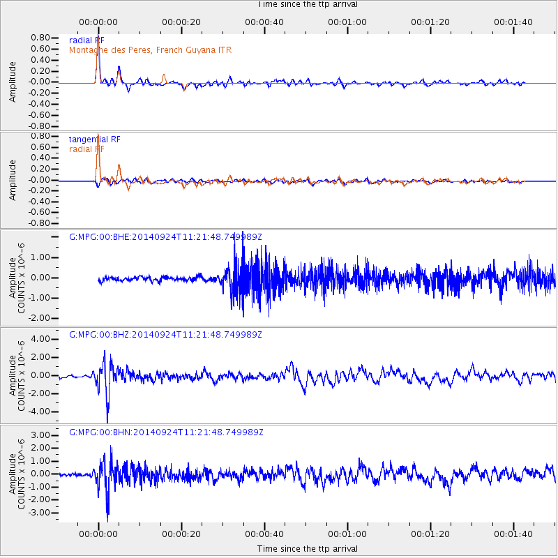
Earthquake location: Jujuy Province, Argentina
Earthquake latitude/longitude: -23.9/-66.6
Earthquake time(UTC): 2014/09/24 (267) 11:16:12 GMT
Earthquake Depth: 189 km
Earthquake Magnitude: 6.2 MWP, 6.2 MWB, 6.2 MWC
Earthquake Catalog/Contributor: NEIC PDE/NEIC COMCAT
Network: G GEOSCOPE
Station: MPG Montagne des Peres, French Guyana
Lat/Lon: 5.11 N/52.64 W
Elevation: 147 m
Distance: 31.8 deg
Az: 27.004 deg
Baz: 204.668 deg
Ray Param: 0.07834269
Estimated Moho Depth: 44.0 km
Estimated Crust Vp/Vs: 1.68
Assumed Crust Vp: 6.472 km/s
Estimated Crust Vs: 3.858 km/s
Estimated Crust Poisson's Ratio: 0.22
Radial Match: 93.22563 %
Radial Bump: 345
Transverse Match: 66.45784 %
Transverse Bump: 400
SOD ConfigId: 796777
Insert Time: 2014-10-08 11:36:51.430 +0000
GWidth: 2.5
Max Bumps: 400
Tol: 0.001

Signal To Noise

ChannelStoNSTALTA
G:MPG:00:BHZ:20140924T11:21:48.749989Z15.1170311.697733E-61.1230597E-7
G:MPG:00:BHN:20140924T11:21:48.749989Z18.7707311.1659214E-66.21138E-8
G:MPG:00:BHE:20140924T11:21:48.749989Z8.0423867.384866E-79.182431E-8
Arrivals
Ps5.0 SECOND
PpPs17 SECOND
PsPs/PpSs22 SECOND