You are here: Home > Network List > TA - USArray Transportable Network (new EarthScope stations) Stations List
> Station Q58A Fox Den Farm, The Plains, VA, USA > Earthquake Result Viewer
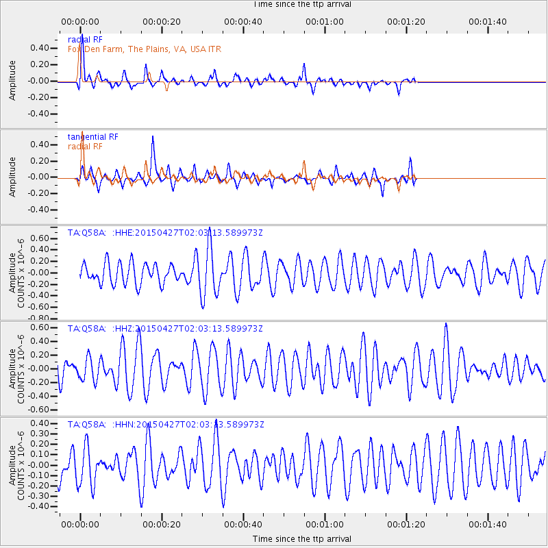
Q58A Fox Den Farm, The Plains, VA, USA - Earthquake Result Viewer
*The percent match for this event was below the threshold and hence no stack was calculated.
| Earthquake location: |
Kuril Islands |
| Earthquake latitude/longitude: |
45.0/150.9 |
| Earthquake time(UTC): |
2015/04/27 (117) 01:51:17 GMT |
| Earthquake Depth: |
100 km |
| Earthquake Magnitude: |
4.2 mb, 3.9 mb |
| Earthquake Catalog/Contributor: |
ISC/ISC |
|
| Network: |
TA USArray Transportable Network (new EarthScope stations) |
| Station: |
Q58A Fox Den Farm, The Plains, VA, USA |
| Lat/Lon: |
38.94 N/77.68 W |
| Elevation: |
182 m |
|
| Distance: |
85.7 deg |
| Az: |
35.922 deg |
| Baz: |
327.762 deg |
| Ray Param: |
$rayparam |
*The percent match for this event was below the threshold and hence was not used in the summary stack. |
|
| Radial Match: |
64.94395 % |
| Radial Bump: |
400 |
| Transverse Match: |
56.929714 % |
| Transverse Bump: |
276 |
| SOD ConfigId: |
7422571 |
| Insert Time: |
2019-04-18 13:23:30.333 +0000 |
| GWidth: |
2.5 |
| Max Bumps: |
400 |
| Tol: |
0.001 |
|
Signal To Noise
| Channel | StoN | STA | LTA |
| TA:Q58A: :HHZ:20150427T02:03:13.589973Z | 0.43680498 | 1.63933E-7 | 3.753002E-7 |
| TA:Q58A: :HHN:20150427T02:03:13.589973Z | 0.8609714 | 1.9134656E-7 | 2.2224496E-7 |
| TA:Q58A: :HHE:20150427T02:03:13.589973Z | 2.4707708 | 4.244329E-7 | 1.7178158E-7 |
| Arrivals |
| Ps | |
| PpPs | |
| PsPs/PpSs | |


