You are here: Home > Network List > TA - USArray Transportable Network (new EarthScope stations) Stations List
> Station J61A Chester, VT, USA > Earthquake Result Viewer
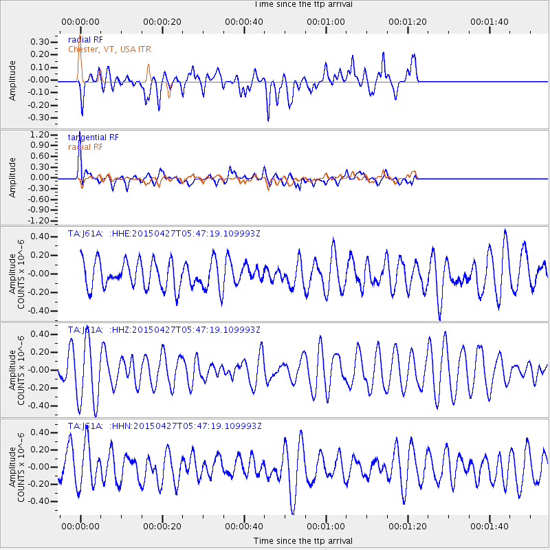
J61A Chester, VT, USA - Earthquake Result Viewer
*The percent match for this event was below the threshold and hence no stack was calculated.
| Earthquake location: |
Southern Iran |
| Earthquake latitude/longitude: |
26.4/53.5 |
| Earthquake time(UTC): |
2015/04/27 (117) 05:34:31 GMT |
| Earthquake Depth: |
28 km |
| Earthquake Magnitude: |
4.8 MW, 4.8 mb, 4.0 MS |
| Earthquake Catalog/Contributor: |
ISC/ISC |
|
| Network: |
TA USArray Transportable Network (new EarthScope stations) |
| Station: |
J61A Chester, VT, USA |
| Lat/Lon: |
43.35 N/72.55 W |
| Elevation: |
253 m |
|
| Distance: |
94.8 deg |
| Az: |
323.716 deg |
| Baz: |
46.707 deg |
| Ray Param: |
$rayparam |
*The percent match for this event was below the threshold and hence was not used in the summary stack. |
|
| Radial Match: |
58.966324 % |
| Radial Bump: |
400 |
| Transverse Match: |
58.966984 % |
| Transverse Bump: |
400 |
| SOD ConfigId: |
7422571 |
| Insert Time: |
2019-04-18 13:28:18.755 +0000 |
| GWidth: |
2.5 |
| Max Bumps: |
400 |
| Tol: |
0.001 |
|
Signal To Noise
| Channel | StoN | STA | LTA |
| TA:J61A: :HHZ:20150427T05:47:19.109993Z | 2.436966 | 3.5774474E-7 | 1.4679922E-7 |
| TA:J61A: :HHN:20150427T05:47:19.109993Z | 1.8397465 | 2.5277276E-7 | 1.3739542E-7 |
| TA:J61A: :HHE:20150427T05:47:19.109993Z | 1.1697086 | 1.6887836E-7 | 1.4437644E-7 |
| Arrivals |
| Ps | |
| PpPs | |
| PsPs/PpSs | |


