You are here: Home > Network List > TA - USArray Transportable Network (new EarthScope stations) Stations List
> Station O03E Paynes Creek, CA, USA > Earthquake Result Viewer
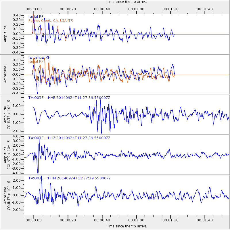
O03E Paynes Creek, CA, USA - Earthquake Result Viewer
*The percent match for this event was below the threshold and hence no stack was calculated.
| Earthquake location: |
Jujuy Province, Argentina |
| Earthquake latitude/longitude: |
-23.9/-66.6 |
| Earthquake time(UTC): |
2014/09/24 (267) 11:16:12 GMT |
| Earthquake Depth: |
189 km |
| Earthquake Magnitude: |
6.2 MWP, 6.2 MWB, 6.2 MWC |
| Earthquake Catalog/Contributor: |
NEIC PDE/NEIC COMCAT |
|
| Network: |
TA USArray Transportable Network (new EarthScope stations) |
| Station: |
O03E Paynes Creek, CA, USA |
| Lat/Lon: |
40.29 N/121.80 W |
| Elevation: |
967 m |
|
| Distance: |
81.9 deg |
| Az: |
320.602 deg |
| Baz: |
130.556 deg |
| Ray Param: |
$rayparam |
*The percent match for this event was below the threshold and hence was not used in the summary stack. |
|
| Radial Match: |
60.257275 % |
| Radial Bump: |
400 |
| Transverse Match: |
51.812515 % |
| Transverse Bump: |
400 |
| SOD ConfigId: |
796777 |
| Insert Time: |
2014-10-08 12:01:34.584 +0000 |
| GWidth: |
2.5 |
| Max Bumps: |
400 |
| Tol: |
0.001 |
|
Signal To Noise
| Channel | StoN | STA | LTA |
| TA:O03E: :HHZ:20140924T11:27:39.550007Z | 5.38904 | 1.686043E-6 | 3.1286518E-7 |
| TA:O03E: :HHN:20140924T11:27:39.550007Z | 2.068431 | 8.42189E-7 | 4.0716324E-7 |
| TA:O03E: :HHE:20140924T11:27:39.550007Z | 1.135006 | 4.171827E-7 | 3.675599E-7 |
| Arrivals |
| Ps | |
| PpPs | |
| PsPs/PpSs | |


