You are here: Home > Network List > TA - USArray Transportable Network (new EarthScope stations) Stations List
> Station P56A Dayton Farm, Ripley, WV, USA > Earthquake Result Viewer
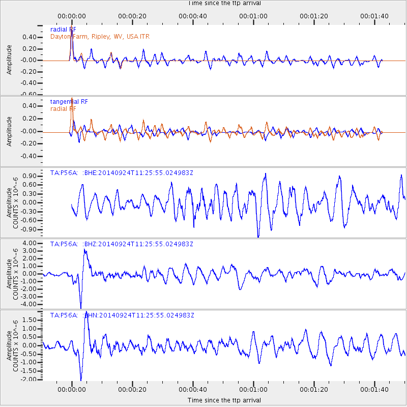
P56A Dayton Farm, Ripley, WV, USA - Earthquake Result Viewer
*The percent match for this event was below the threshold and hence no stack was calculated.
| Earthquake location: |
Jujuy Province, Argentina |
| Earthquake latitude/longitude: |
-23.9/-66.6 |
| Earthquake time(UTC): |
2014/09/24 (267) 11:16:12 GMT |
| Earthquake Depth: |
189 km |
| Earthquake Magnitude: |
6.2 MWP, 6.2 MWB, 6.2 MWC |
| Earthquake Catalog/Contributor: |
NEIC PDE/NEIC COMCAT |
|
| Network: |
TA USArray Transportable Network (new EarthScope stations) |
| Station: |
P56A Dayton Farm, Ripley, WV, USA |
| Lat/Lon: |
39.50 N/78.84 W |
| Elevation: |
249 m |
|
| Distance: |
64.1 deg |
| Az: |
349.452 deg |
| Baz: |
167.488 deg |
| Ray Param: |
$rayparam |
*The percent match for this event was below the threshold and hence was not used in the summary stack. |
|
| Radial Match: |
70.21921 % |
| Radial Bump: |
377 |
| Transverse Match: |
58.542072 % |
| Transverse Bump: |
337 |
| SOD ConfigId: |
796777 |
| Insert Time: |
2014-10-08 12:02:16.706 +0000 |
| GWidth: |
2.5 |
| Max Bumps: |
400 |
| Tol: |
0.001 |
|
Signal To Noise
| Channel | StoN | STA | LTA |
| TA:P56A: :BHZ:20140924T11:25:55.024983Z | 6.9521914 | 1.8860285E-6 | 2.7128547E-7 |
| TA:P56A: :BHN:20140924T11:25:55.024983Z | 2.7576241 | 9.684743E-7 | 3.511988E-7 |
| TA:P56A: :BHE:20140924T11:25:55.024983Z | 1.429638 | 3.5361407E-7 | 2.4734518E-7 |
| Arrivals |
| Ps | |
| PpPs | |
| PsPs/PpSs | |


