You are here: Home > Network List > AV - Alaska Volcano Observatory Stations List
> Station SPCR Ckakachatna River, Mount Spurr, Alaska > Earthquake Result Viewer
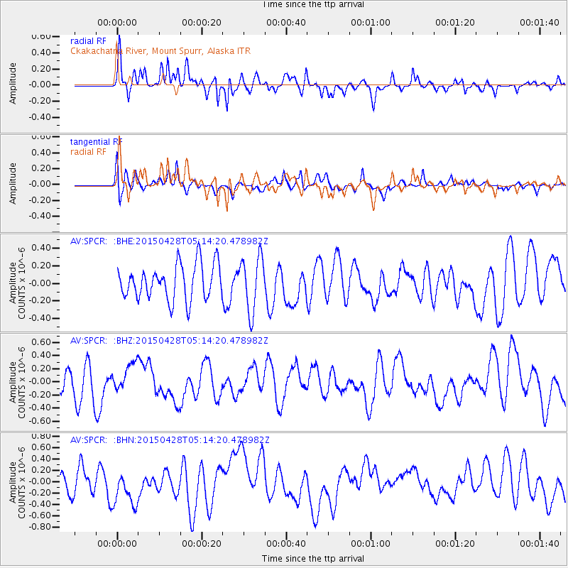
SPCR Ckakachatna River, Mount Spurr, Alaska - Earthquake Result Viewer
*The percent match for this event was below the threshold and hence no stack was calculated.
| Earthquake location: |
Afghanistan-Tajikistan Bord Reg. |
| Earthquake latitude/longitude: |
37.3/71.9 |
| Earthquake time(UTC): |
2015/04/28 (118) 05:03:25 GMT |
| Earthquake Depth: |
164 km |
| Earthquake Magnitude: |
4.8 MW, 4.5 mb |
| Earthquake Catalog/Contributor: |
ISC/ISC |
|
| Network: |
AV Alaska Volcano Observatory |
| Station: |
SPCR Ckakachatna River, Mount Spurr, Alaska |
| Lat/Lon: |
61.20 N/152.21 W |
| Elevation: |
984 m |
|
| Distance: |
75.5 deg |
| Az: |
20.381 deg |
| Baz: |
324.984 deg |
| Ray Param: |
$rayparam |
*The percent match for this event was below the threshold and hence was not used in the summary stack. |
|
| Radial Match: |
64.3424 % |
| Radial Bump: |
400 |
| Transverse Match: |
51.825325 % |
| Transverse Bump: |
400 |
| SOD ConfigId: |
7422571 |
| Insert Time: |
2019-04-18 13:33:32.566 +0000 |
| GWidth: |
2.5 |
| Max Bumps: |
400 |
| Tol: |
0.001 |
|
Signal To Noise
| Channel | StoN | STA | LTA |
| AV:SPCR: :BHZ:20150428T05:14:20.478982Z | 0.8942507 | 2.1830401E-7 | 2.441195E-7 |
| AV:SPCR: :BHN:20150428T05:14:20.478982Z | 1.4313694 | 3.3994397E-7 | 2.3749561E-7 |
| AV:SPCR: :BHE:20150428T05:14:20.478982Z | 1.5701416 | 3.1624006E-7 | 2.0140864E-7 |
| Arrivals |
| Ps | |
| PpPs | |
| PsPs/PpSs | |


