You are here: Home > Network List > TA - USArray Transportable Network (new EarthScope stations) Stations List
> Station W41B Gary Mavity, Velonia, AR, USA > Earthquake Result Viewer
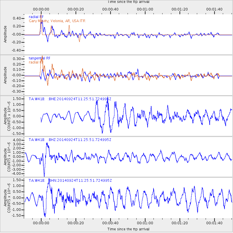
W41B Gary Mavity, Velonia, AR, USA - Earthquake Result Viewer
*The percent match for this event was below the threshold and hence no stack was calculated.
| Earthquake location: |
Jujuy Province, Argentina |
| Earthquake latitude/longitude: |
-23.9/-66.6 |
| Earthquake time(UTC): |
2014/09/24 (267) 11:16:12 GMT |
| Earthquake Depth: |
189 km |
| Earthquake Magnitude: |
6.2 MWP, 6.2 MWB, 6.2 MWC |
| Earthquake Catalog/Contributor: |
NEIC PDE/NEIC COMCAT |
|
| Network: |
TA USArray Transportable Network (new EarthScope stations) |
| Station: |
W41B Gary Mavity, Velonia, AR, USA |
| Lat/Lon: |
35.17 N/92.25 W |
| Elevation: |
95 m |
|
| Distance: |
63.6 deg |
| Az: |
336.628 deg |
| Baz: |
153.682 deg |
| Ray Param: |
$rayparam |
*The percent match for this event was below the threshold and hence was not used in the summary stack. |
|
| Radial Match: |
66.479485 % |
| Radial Bump: |
388 |
| Transverse Match: |
45.91828 % |
| Transverse Bump: |
400 |
| SOD ConfigId: |
796777 |
| Insert Time: |
2014-10-08 12:05:01.130 +0000 |
| GWidth: |
2.5 |
| Max Bumps: |
400 |
| Tol: |
0.001 |
|
Signal To Noise
| Channel | StoN | STA | LTA |
| TA:W41B: :BHZ:20140924T11:25:51.724995Z | 5.5161986 | 2.1409608E-6 | 3.881225E-7 |
| TA:W41B: :BHN:20140924T11:25:51.724995Z | 3.24861 | 9.054189E-7 | 2.7870965E-7 |
| TA:W41B: :BHE:20140924T11:25:51.724995Z | 2.5793264 | 6.758028E-7 | 2.6200746E-7 |
| Arrivals |
| Ps | |
| PpPs | |
| PsPs/PpSs | |


