You are here: Home > Network List > US - United States National Seismic Network Stations List
> Station AMTX Amarillo, Texas, USA > Earthquake Result Viewer
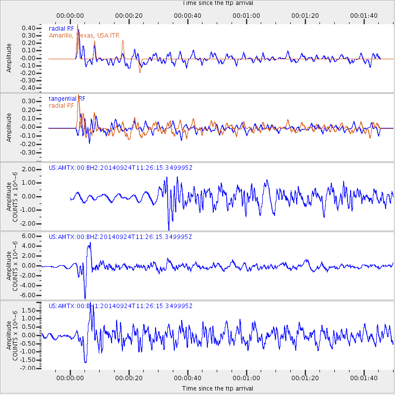
AMTX Amarillo, Texas, USA - Earthquake Result Viewer
*The percent match for this event was below the threshold and hence no stack was calculated.
| Earthquake location: |
Jujuy Province, Argentina |
| Earthquake latitude/longitude: |
-23.9/-66.6 |
| Earthquake time(UTC): |
2014/09/24 (267) 11:16:12 GMT |
| Earthquake Depth: |
189 km |
| Earthquake Magnitude: |
6.2 MWP, 6.2 MWB, 6.2 MWC |
| Earthquake Catalog/Contributor: |
NEIC PDE/NEIC COMCAT |
|
| Network: |
US United States National Seismic Network |
| Station: |
AMTX Amarillo, Texas, USA |
| Lat/Lon: |
34.53 N/101.41 W |
| Elevation: |
1010 m |
|
| Distance: |
66.8 deg |
| Az: |
329.122 deg |
| Baz: |
145.309 deg |
| Ray Param: |
$rayparam |
*The percent match for this event was below the threshold and hence was not used in the summary stack. |
|
| Radial Match: |
71.44112 % |
| Radial Bump: |
400 |
| Transverse Match: |
64.70942 % |
| Transverse Bump: |
400 |
| SOD ConfigId: |
796777 |
| Insert Time: |
2014-10-08 12:06:53.241 +0000 |
| GWidth: |
2.5 |
| Max Bumps: |
400 |
| Tol: |
0.001 |
|
Signal To Noise
| Channel | StoN | STA | LTA |
| US:AMTX:00:BHZ:20140924T11:26:15.349995Z | 6.728229 | 1.4551428E-6 | 2.1627427E-7 |
| US:AMTX:00:BH1:20140924T11:26:15.349995Z | 1.6642317 | 4.0955857E-7 | 2.460947E-7 |
| US:AMTX:00:BH2:20140924T11:26:15.349995Z | 2.790723 | 4.915307E-7 | 1.7613026E-7 |
| Arrivals |
| Ps | |
| PpPs | |
| PsPs/PpSs | |


