You are here: Home > Network List > US - United States National Seismic Network Stations List
> Station MSO Missoula, Montana, USA > Earthquake Result Viewer
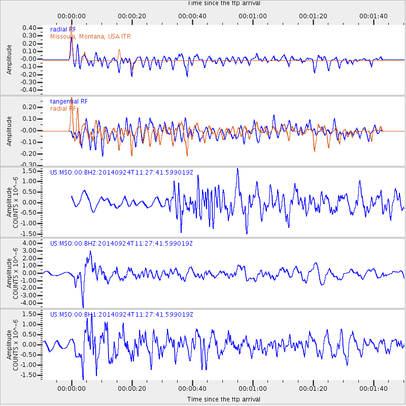
MSO Missoula, Montana, USA - Earthquake Result Viewer
*The percent match for this event was below the threshold and hence no stack was calculated.
| Earthquake location: |
Jujuy Province, Argentina |
| Earthquake latitude/longitude: |
-23.9/-66.6 |
| Earthquake time(UTC): |
2014/09/24 (267) 11:16:12 GMT |
| Earthquake Depth: |
189 km |
| Earthquake Magnitude: |
6.2 MWP, 6.2 MWB, 6.2 MWC |
| Earthquake Catalog/Contributor: |
NEIC PDE/NEIC COMCAT |
|
| Network: |
US United States National Seismic Network |
| Station: |
MSO Missoula, Montana, USA |
| Lat/Lon: |
46.83 N/113.94 W |
| Elevation: |
1264 m |
|
| Distance: |
82.3 deg |
| Az: |
329.345 deg |
| Baz: |
137.165 deg |
| Ray Param: |
$rayparam |
*The percent match for this event was below the threshold and hence was not used in the summary stack. |
|
| Radial Match: |
52.196922 % |
| Radial Bump: |
400 |
| Transverse Match: |
47.928673 % |
| Transverse Bump: |
400 |
| SOD ConfigId: |
796777 |
| Insert Time: |
2014-10-08 12:08:22.388 +0000 |
| GWidth: |
2.5 |
| Max Bumps: |
400 |
| Tol: |
0.001 |
|
Signal To Noise
| Channel | StoN | STA | LTA |
| US:MSO:00:BHZ:20140924T11:27:41.599019Z | 4.039503 | 1.4413588E-6 | 3.5681586E-7 |
| US:MSO:00:BH1:20140924T11:27:41.599019Z | 2.6631644 | 6.313845E-7 | 2.3708056E-7 |
| US:MSO:00:BH2:20140924T11:27:41.599019Z | 1.5237323 | 3.233921E-7 | 2.1223683E-7 |
| Arrivals |
| Ps | |
| PpPs | |
| PsPs/PpSs | |


