You are here: Home > Network List > TA - USArray Transportable Network (new EarthScope stations) Stations List
> Station R11A Troy Canyon, Currant, NV, USA > Earthquake Result Viewer
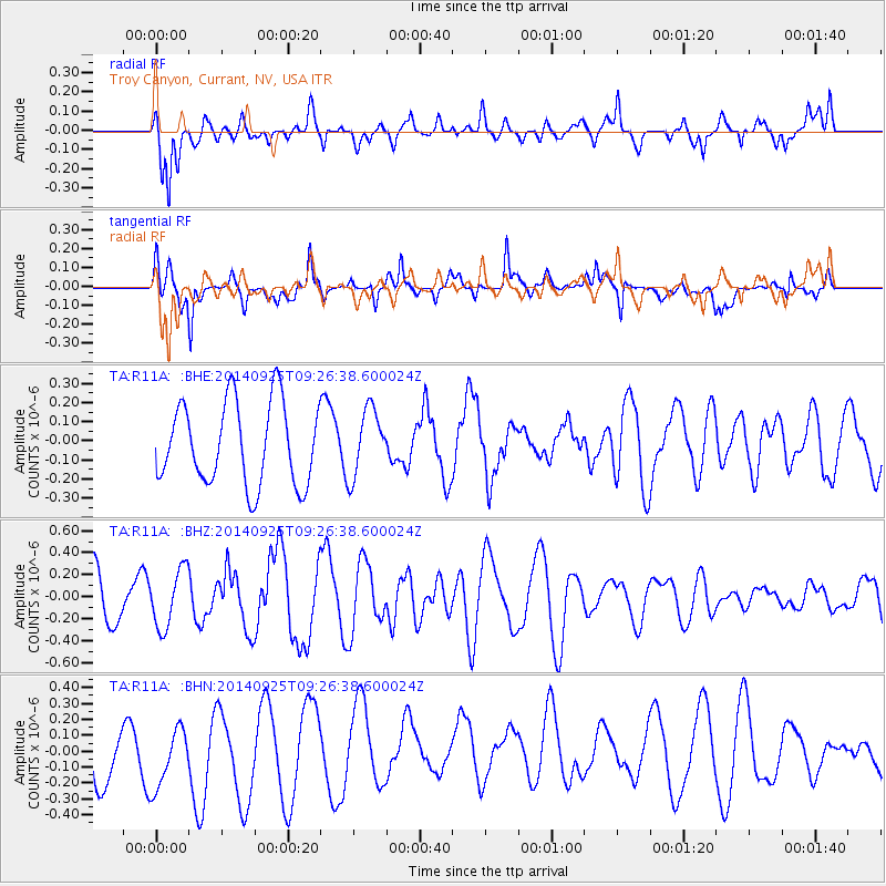
R11A Troy Canyon, Currant, NV, USA - Earthquake Result Viewer
*The percent match for this event was below the threshold and hence no stack was calculated.
| Earthquake location: |
Solomon Islands |
| Earthquake latitude/longitude: |
-9.5/156.4 |
| Earthquake time(UTC): |
2014/09/25 (268) 09:13:50 GMT |
| Earthquake Depth: |
10 km |
| Earthquake Magnitude: |
6.0 MB |
| Earthquake Catalog/Contributor: |
NEIC PDE/NEIC COMCAT |
|
| Network: |
TA USArray Transportable Network (new EarthScope stations) |
| Station: |
R11A Troy Canyon, Currant, NV, USA |
| Lat/Lon: |
38.35 N/115.59 W |
| Elevation: |
1756 m |
|
| Distance: |
94.3 deg |
| Az: |
51.997 deg |
| Baz: |
261.368 deg |
| Ray Param: |
$rayparam |
*The percent match for this event was below the threshold and hence was not used in the summary stack. |
|
| Radial Match: |
65.25441 % |
| Radial Bump: |
400 |
| Transverse Match: |
77.71089 % |
| Transverse Bump: |
400 |
| SOD ConfigId: |
796777 |
| Insert Time: |
2014-10-09 09:35:14.424 +0000 |
| GWidth: |
2.5 |
| Max Bumps: |
400 |
| Tol: |
0.001 |
|
Signal To Noise
| Channel | StoN | STA | LTA |
| TA:R11A: :BHZ:20140925T09:26:38.600024Z | 1.1405747 | 2.6379425E-7 | 2.3128187E-7 |
| TA:R11A: :BHN:20140925T09:26:38.600024Z | 1.1423221 | 2.2208671E-7 | 1.944169E-7 |
| TA:R11A: :BHE:20140925T09:26:38.600024Z | 0.8228274 | 1.7596037E-7 | 2.1384847E-7 |
| Arrivals |
| Ps | |
| PpPs | |
| PsPs/PpSs | |


