You are here: Home > Network List > AZ - ANZA Regional Network Stations List
> Station PFO AZ.PFO > Earthquake Result Viewer
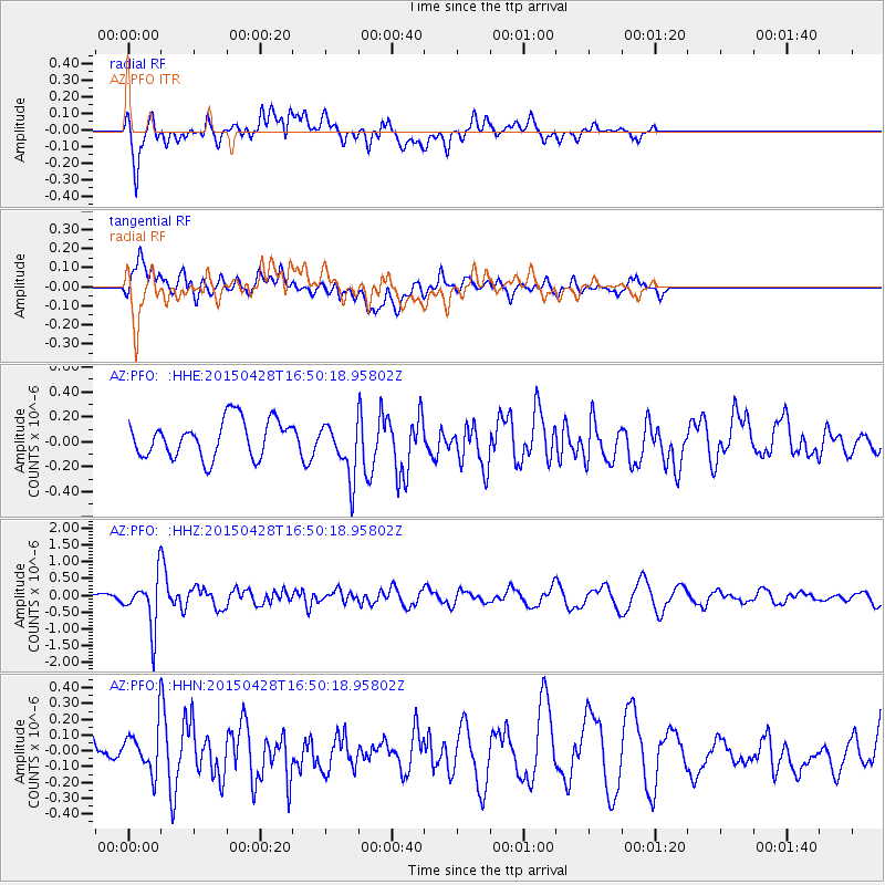
PFO AZ.PFO - Earthquake Result Viewer
*The percent match for this event was below the threshold and hence no stack was calculated.
| Earthquake location: |
Fiji Islands Region |
| Earthquake latitude/longitude: |
-20.9/-178.7 |
| Earthquake time(UTC): |
2015/04/28 (118) 16:39:38 GMT |
| Earthquake Depth: |
579 km |
| Earthquake Magnitude: |
6.2 MWB |
| Earthquake Catalog/Contributor: |
NEIC PDE/NEIC COMCAT |
|
| Network: |
AZ ANZA Regional Network |
| Station: |
PFO AZ.PFO |
| Lat/Lon: |
33.61 N/116.46 W |
| Elevation: |
1259 m |
|
| Distance: |
80.3 deg |
| Az: |
48.492 deg |
| Baz: |
237.029 deg |
| Ray Param: |
$rayparam |
*The percent match for this event was below the threshold and hence was not used in the summary stack. |
|
| Radial Match: |
62.37868 % |
| Radial Bump: |
400 |
| Transverse Match: |
62.86405 % |
| Transverse Bump: |
400 |
| SOD ConfigId: |
7422571 |
| Insert Time: |
2019-04-18 13:51:41.903 +0000 |
| GWidth: |
2.5 |
| Max Bumps: |
400 |
| Tol: |
0.001 |
|
Signal To Noise
| Channel | StoN | STA | LTA |
| AZ:PFO: :HHZ:20150428T16:50:18.95802Z | 7.199403 | 7.827403E-7 | 1.0872294E-7 |
| AZ:PFO: :HHN:20150428T16:50:18.95802Z | 1.6689847 | 1.5131269E-7 | 9.066152E-8 |
| AZ:PFO: :HHE:20150428T16:50:18.95802Z | 1.5689116 | 2.3411936E-7 | 1.4922406E-7 |
| Arrivals |
| Ps | |
| PpPs | |
| PsPs/PpSs | |


