You are here: Home > Network List > AZ - ANZA Regional Network Stations List
> Station SMER AZ.SMER > Earthquake Result Viewer
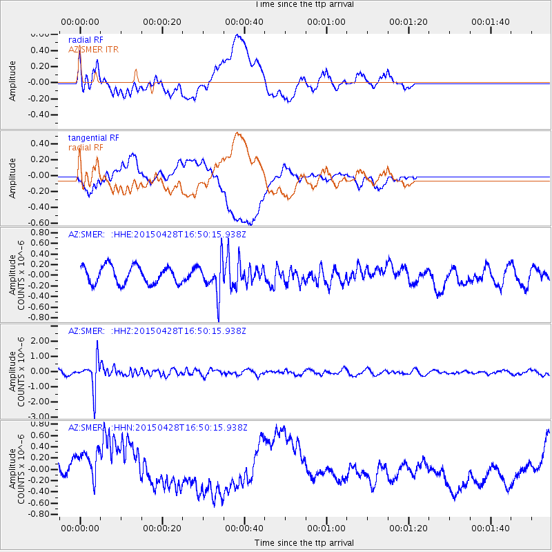
SMER AZ.SMER - Earthquake Result Viewer
*The percent match for this event was below the threshold and hence no stack was calculated.
| Earthquake location: |
Fiji Islands Region |
| Earthquake latitude/longitude: |
-20.9/-178.7 |
| Earthquake time(UTC): |
2015/04/28 (118) 16:39:38 GMT |
| Earthquake Depth: |
579 km |
| Earthquake Magnitude: |
6.2 MWB |
| Earthquake Catalog/Contributor: |
NEIC PDE/NEIC COMCAT |
|
| Network: |
AZ ANZA Regional Network |
| Station: |
SMER AZ.SMER |
| Lat/Lon: |
33.46 N/117.17 W |
| Elevation: |
355 m |
|
| Distance: |
79.7 deg |
| Az: |
48.292 deg |
| Baz: |
236.603 deg |
| Ray Param: |
$rayparam |
*The percent match for this event was below the threshold and hence was not used in the summary stack. |
|
| Radial Match: |
42.84882 % |
| Radial Bump: |
400 |
| Transverse Match: |
23.262266 % |
| Transverse Bump: |
400 |
| SOD ConfigId: |
7422571 |
| Insert Time: |
2019-04-18 13:51:43.167 +0000 |
| GWidth: |
2.5 |
| Max Bumps: |
400 |
| Tol: |
0.001 |
|
Signal To Noise
| Channel | StoN | STA | LTA |
| AZ:SMER: :HHZ:20150428T16:50:15.938Z | 8.054164 | 9.828655E-7 | 1.2203196E-7 |
| AZ:SMER: :HHN:20150428T16:50:15.938Z | 2.3491194 | 4.371889E-7 | 1.8610757E-7 |
| AZ:SMER: :HHE:20150428T16:50:15.938Z | 1.9454235 | 3.1791907E-7 | 1.6341896E-7 |
| Arrivals |
| Ps | |
| PpPs | |
| PsPs/PpSs | |


