You are here: Home > Network List > CI - Caltech Regional Seismic Network Stations List
> Station DAN Danby, California, USA > Earthquake Result Viewer
DAN Danby, California, USA - Earthquake Result Viewer
*The percent match for this event was below the threshold and hence no stack was calculated.
| Earthquake location: |
Fiji Islands Region |
| Earthquake latitude/longitude: |
-20.9/-178.7 |
| Earthquake time(UTC): |
2015/04/28 (118) 16:39:38 GMT |
| Earthquake Depth: |
579 km |
| Earthquake Magnitude: |
6.2 MWB |
| Earthquake Catalog/Contributor: |
NEIC PDE/NEIC COMCAT |
|
| Network: |
CI Caltech Regional Seismic Network |
| Station: |
DAN Danby, California, USA |
| Lat/Lon: |
34.64 N/115.38 W |
| Elevation: |
398 m |
|
| Distance: |
81.6 deg |
| Az: |
48.11 deg |
| Baz: |
237.571 deg |
| Ray Param: |
$rayparam |
*The percent match for this event was below the threshold and hence was not used in the summary stack. |
|
| Radial Match: |
79.468414 % |
| Radial Bump: |
400 |
| Transverse Match: |
59.623875 % |
| Transverse Bump: |
400 |
| SOD ConfigId: |
7422571 |
| Insert Time: |
2019-04-18 13:52:35.450 +0000 |
| GWidth: |
2.5 |
| Max Bumps: |
400 |
| Tol: |
0.001 |
|
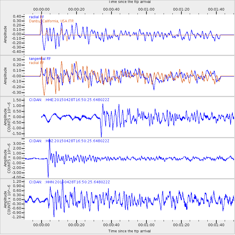
Signal To Noise
| Channel | StoN | STA | LTA |
| CI:DAN: :HHZ:20150428T16:50:25.648022Z | 14.595191 | 1.4889074E-6 | 1.0201356E-7 |
| CI:DAN: :HHN:20150428T16:50:25.648022Z | 1.1602788 | 1.8549656E-7 | 1.598724E-7 |
| CI:DAN: :HHE:20150428T16:50:25.648022Z | 3.273995 | 5.502646E-7 | 1.6807131E-7 |
| Arrivals |
| Ps | |
| PpPs | |
| PsPs/PpSs | |


