You are here: Home > Network List > CN - Canadian National Seismograph Network Stations List
> Station INK INUVIK, NT > Earthquake Result Viewer
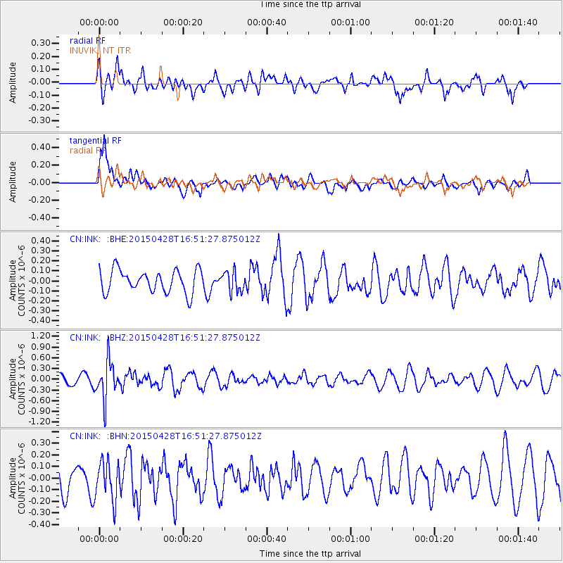
INK INUVIK, NT - Earthquake Result Viewer
*The percent match for this event was below the threshold and hence no stack was calculated.
| Earthquake location: |
Fiji Islands Region |
| Earthquake latitude/longitude: |
-20.9/-178.7 |
| Earthquake time(UTC): |
2015/04/28 (118) 16:39:38 GMT |
| Earthquake Depth: |
579 km |
| Earthquake Magnitude: |
6.2 MWB |
| Earthquake Catalog/Contributor: |
NEIC PDE/NEIC COMCAT |
|
| Network: |
CN Canadian National Seismograph Network |
| Station: |
INK INUVIK, NT |
| Lat/Lon: |
68.31 N/133.53 W |
| Elevation: |
44 m |
|
| Distance: |
94.8 deg |
| Az: |
15.333 deg |
| Baz: |
221.678 deg |
| Ray Param: |
$rayparam |
*The percent match for this event was below the threshold and hence was not used in the summary stack. |
|
| Radial Match: |
57.156456 % |
| Radial Bump: |
400 |
| Transverse Match: |
64.72956 % |
| Transverse Bump: |
400 |
| SOD ConfigId: |
7422571 |
| Insert Time: |
2019-04-18 13:53:16.599 +0000 |
| GWidth: |
2.5 |
| Max Bumps: |
400 |
| Tol: |
0.001 |
|
Signal To Noise
| Channel | StoN | STA | LTA |
| CN:INK: :BHZ:20150428T16:51:27.875012Z | 4.3219233 | 5.4492085E-7 | 1.2608295E-7 |
| CN:INK: :BHN:20150428T16:51:27.875012Z | 0.95951813 | 1.6625764E-7 | 1.7327201E-7 |
| CN:INK: :BHE:20150428T16:51:27.875012Z | 0.901644 | 1.02053335E-7 | 1.1318584E-7 |
| Arrivals |
| Ps | |
| PpPs | |
| PsPs/PpSs | |


