You are here: Home > Network List > TA - USArray Transportable Network (new EarthScope stations) Stations List
> Station G03D McMinnville, OR, USA > Earthquake Result Viewer
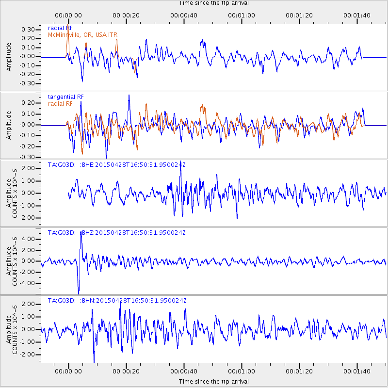
G03D McMinnville, OR, USA - Earthquake Result Viewer
*The percent match for this event was below the threshold and hence no stack was calculated.
| Earthquake location: |
Fiji Islands Region |
| Earthquake latitude/longitude: |
-20.9/-178.7 |
| Earthquake time(UTC): |
2015/04/28 (118) 16:39:38 GMT |
| Earthquake Depth: |
579 km |
| Earthquake Magnitude: |
6.2 MWB |
| Earthquake Catalog/Contributor: |
NEIC PDE/NEIC COMCAT |
|
| Network: |
TA USArray Transportable Network (new EarthScope stations) |
| Station: |
G03D McMinnville, OR, USA |
| Lat/Lon: |
45.21 N/123.26 W |
| Elevation: |
222 m |
|
| Distance: |
82.9 deg |
| Az: |
35.898 deg |
| Baz: |
230.849 deg |
| Ray Param: |
$rayparam |
*The percent match for this event was below the threshold and hence was not used in the summary stack. |
|
| Radial Match: |
55.916912 % |
| Radial Bump: |
397 |
| Transverse Match: |
73.908264 % |
| Transverse Bump: |
400 |
| SOD ConfigId: |
7422571 |
| Insert Time: |
2019-04-18 13:55:34.134 +0000 |
| GWidth: |
2.5 |
| Max Bumps: |
400 |
| Tol: |
0.001 |
|
Signal To Noise
| Channel | StoN | STA | LTA |
| TA:G03D: :BHZ:20150428T16:50:31.950024Z | 7.4407744 | 2.359385E-6 | 3.1708862E-7 |
| TA:G03D: :BHN:20150428T16:50:31.950024Z | 1.2288358 | 4.417352E-7 | 3.5947454E-7 |
| TA:G03D: :BHE:20150428T16:50:31.950024Z | 0.83285457 | 4.1044072E-7 | 4.9281203E-7 |
| Arrivals |
| Ps | |
| PpPs | |
| PsPs/PpSs | |


