You are here: Home > Network List > TA - USArray Transportable Network (new EarthScope stations) Stations List
> Station L04D Klamath Falls, OR, USA > Earthquake Result Viewer
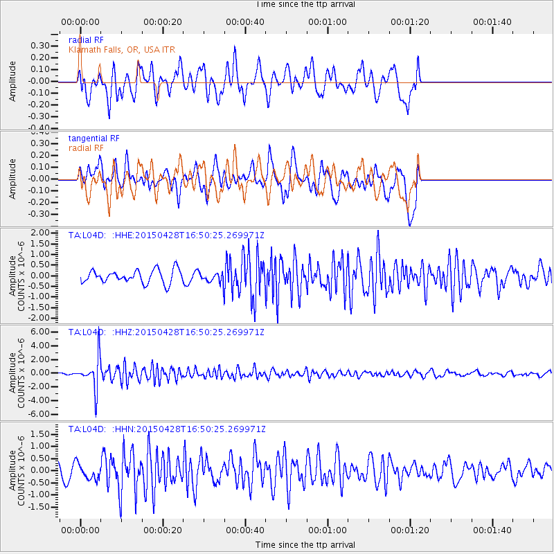
L04D Klamath Falls, OR, USA - Earthquake Result Viewer
*The percent match for this event was below the threshold and hence no stack was calculated.
| Earthquake location: |
Fiji Islands Region |
| Earthquake latitude/longitude: |
-20.9/-178.7 |
| Earthquake time(UTC): |
2015/04/28 (118) 16:39:38 GMT |
| Earthquake Depth: |
579 km |
| Earthquake Magnitude: |
6.2 MWB |
| Earthquake Catalog/Contributor: |
NEIC PDE/NEIC COMCAT |
|
| Network: |
TA USArray Transportable Network (new EarthScope stations) |
| Station: |
L04D Klamath Falls, OR, USA |
| Lat/Lon: |
42.22 N/122.30 W |
| Elevation: |
1437 m |
|
| Distance: |
81.5 deg |
| Az: |
38.696 deg |
| Baz: |
231.89 deg |
| Ray Param: |
$rayparam |
*The percent match for this event was below the threshold and hence was not used in the summary stack. |
|
| Radial Match: |
58.021843 % |
| Radial Bump: |
400 |
| Transverse Match: |
72.50004 % |
| Transverse Bump: |
400 |
| SOD ConfigId: |
7422571 |
| Insert Time: |
2019-04-18 13:55:47.028 +0000 |
| GWidth: |
2.5 |
| Max Bumps: |
400 |
| Tol: |
0.001 |
|
Signal To Noise
| Channel | StoN | STA | LTA |
| TA:L04D: :HHZ:20150428T16:50:25.269971Z | 17.55174 | 2.4274989E-6 | 1.3830531E-7 |
| TA:L04D: :HHN:20150428T16:50:25.269971Z | 1.1450785 | 3.058583E-7 | 2.6710683E-7 |
| TA:L04D: :HHE:20150428T16:50:25.269971Z | 1.0981174 | 3.3860937E-7 | 3.0835443E-7 |
| Arrivals |
| Ps | |
| PpPs | |
| PsPs/PpSs | |


