You are here: Home > Network List > TA - USArray Transportable Network (new EarthScope stations) Stations List
> Station Q24A Divide, CO, USA > Earthquake Result Viewer
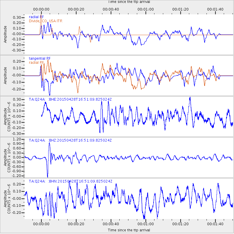
Q24A Divide, CO, USA - Earthquake Result Viewer
*The percent match for this event was below the threshold and hence no stack was calculated.
| Earthquake location: |
Fiji Islands Region |
| Earthquake latitude/longitude: |
-20.9/-178.7 |
| Earthquake time(UTC): |
2015/04/28 (118) 16:39:38 GMT |
| Earthquake Depth: |
579 km |
| Earthquake Magnitude: |
6.2 MWB |
| Earthquake Catalog/Contributor: |
NEIC PDE/NEIC COMCAT |
|
| Network: |
TA USArray Transportable Network (new EarthScope stations) |
| Station: |
Q24A Divide, CO, USA |
| Lat/Lon: |
38.96 N/105.15 W |
| Elevation: |
2775 m |
|
| Distance: |
90.9 deg |
| Az: |
48.384 deg |
| Baz: |
243.706 deg |
| Ray Param: |
$rayparam |
*The percent match for this event was below the threshold and hence was not used in the summary stack. |
|
| Radial Match: |
48.550198 % |
| Radial Bump: |
400 |
| Transverse Match: |
52.42505 % |
| Transverse Bump: |
400 |
| SOD ConfigId: |
7422571 |
| Insert Time: |
2019-04-18 13:55:55.755 +0000 |
| GWidth: |
2.5 |
| Max Bumps: |
400 |
| Tol: |
0.001 |
|
Signal To Noise
| Channel | StoN | STA | LTA |
| TA:Q24A: :BHZ:20150428T16:51:09.825024Z | 4.702604 | 4.9526443E-7 | 1.0531707E-7 |
| TA:Q24A: :BHN:20150428T16:51:09.825024Z | 1.7822928 | 1.5757495E-7 | 8.841137E-8 |
| TA:Q24A: :BHE:20150428T16:51:09.825024Z | 1.4946071 | 1.3395281E-7 | 8.9624095E-8 |
| Arrivals |
| Ps | |
| PpPs | |
| PsPs/PpSs | |


