You are here: Home > Network List > TA - USArray Transportable Network (new EarthScope stations) Stations List
> Station Q53A Leroy, WV, USA > Earthquake Result Viewer
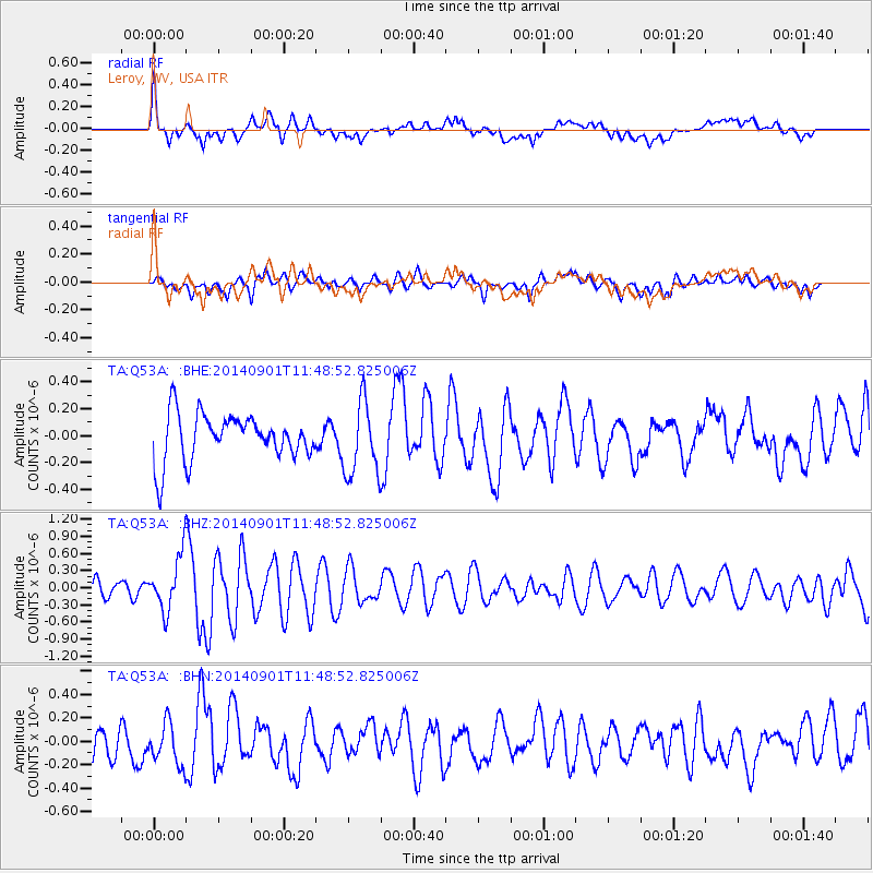
Q53A Leroy, WV, USA - Earthquake Result Viewer
*The percent match for this event was below the threshold and hence no stack was calculated.
| Earthquake location: |
Iceland |
| Earthquake latitude/longitude: |
64.7/-17.5 |
| Earthquake time(UTC): |
2014/09/01 (244) 11:41:10 GMT |
| Earthquake Depth: |
10 km |
| Earthquake Magnitude: |
5.5 MWW, 5.5 MWC |
| Earthquake Catalog/Contributor: |
NEIC PDE/NEIC COMCAT |
|
| Network: |
TA USArray Transportable Network (new EarthScope stations) |
| Station: |
Q53A Leroy, WV, USA |
| Lat/Lon: |
38.86 N/81.53 W |
| Elevation: |
310 m |
|
| Distance: |
44.7 deg |
| Az: |
266.75 deg |
| Baz: |
33.357 deg |
| Ray Param: |
$rayparam |
*The percent match for this event was below the threshold and hence was not used in the summary stack. |
|
| Radial Match: |
76.25274 % |
| Radial Bump: |
400 |
| Transverse Match: |
61.341217 % |
| Transverse Bump: |
400 |
| SOD ConfigId: |
796777 |
| Insert Time: |
2014-10-09 14:38:47.984 +0000 |
| GWidth: |
2.5 |
| Max Bumps: |
400 |
| Tol: |
0.001 |
|
Signal To Noise
| Channel | StoN | STA | LTA |
| TA:Q53A: :BHZ:20140901T11:48:52.825006Z | 3.7836442 | 4.7405752E-7 | 1.2529125E-7 |
| TA:Q53A: :BHN:20140901T11:48:52.825006Z | 1.8398162 | 1.7567639E-7 | 9.548584E-8 |
| TA:Q53A: :BHE:20140901T11:48:52.825006Z | 1.5758879 | 2.7265077E-7 | 1.7301407E-7 |
| Arrivals |
| Ps | |
| PpPs | |
| PsPs/PpSs | |


