You are here: Home > Network List > UW - Pacific Northwest Regional Seismic Network Stations List
> Station LEBA Lebam, WA, USA > Earthquake Result Viewer
LEBA Lebam, WA, USA - Earthquake Result Viewer
*The percent match for this event was below the threshold and hence no stack was calculated.
| Earthquake location: |
Fiji Islands Region |
| Earthquake latitude/longitude: |
-20.9/-178.7 |
| Earthquake time(UTC): |
2015/04/28 (118) 16:39:38 GMT |
| Earthquake Depth: |
579 km |
| Earthquake Magnitude: |
6.2 MWB |
| Earthquake Catalog/Contributor: |
NEIC PDE/NEIC COMCAT |
|
| Network: |
UW Pacific Northwest Regional Seismic Network |
| Station: |
LEBA Lebam, WA, USA |
| Lat/Lon: |
46.55 N/123.56 W |
| Elevation: |
73 m |
|
| Distance: |
83.5 deg |
| Az: |
34.725 deg |
| Baz: |
230.496 deg |
| Ray Param: |
$rayparam |
*The percent match for this event was below the threshold and hence was not used in the summary stack. |
|
| Radial Match: |
71.10095 % |
| Radial Bump: |
400 |
| Transverse Match: |
64.92871 % |
| Transverse Bump: |
400 |
| SOD ConfigId: |
7422571 |
| Insert Time: |
2019-04-18 13:56:57.617 +0000 |
| GWidth: |
2.5 |
| Max Bumps: |
400 |
| Tol: |
0.001 |
|
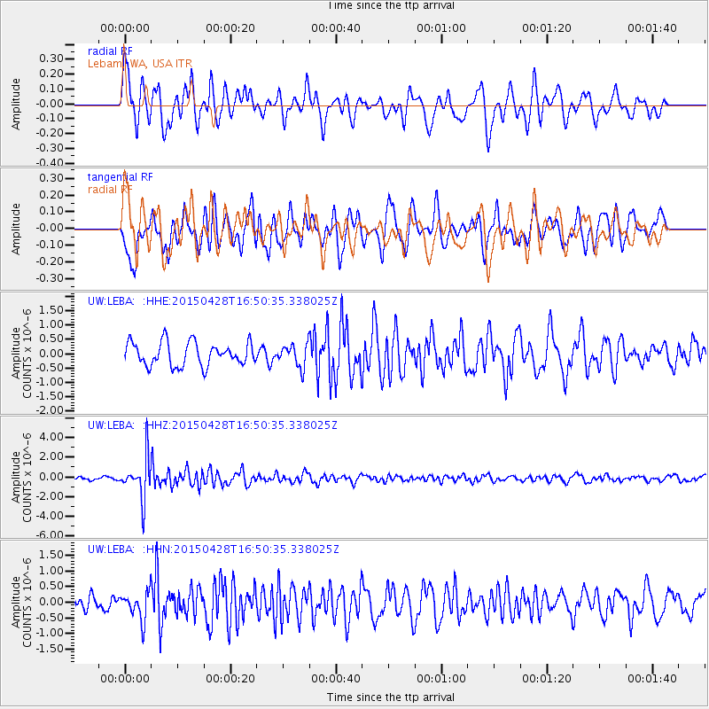
Signal To Noise
| Channel | StoN | STA | LTA |
| UW:LEBA: :HHZ:20150428T16:50:35.338025Z | 8.21494 | 2.122147E-6 | 2.5832776E-7 |
| UW:LEBA: :HHN:20150428T16:50:35.338025Z | 1.3168739 | 4.568258E-7 | 3.4690171E-7 |
| UW:LEBA: :HHE:20150428T16:50:35.338025Z | 1.0211498 | 4.1603096E-7 | 4.0741423E-7 |
| Arrivals |
| Ps | |
| PpPs | |
| PsPs/PpSs | |


