You are here: Home > Network List > UW - Pacific Northwest Regional Seismic Network Stations List
> Station MRBL Marblemount, WA, USA > Earthquake Result Viewer
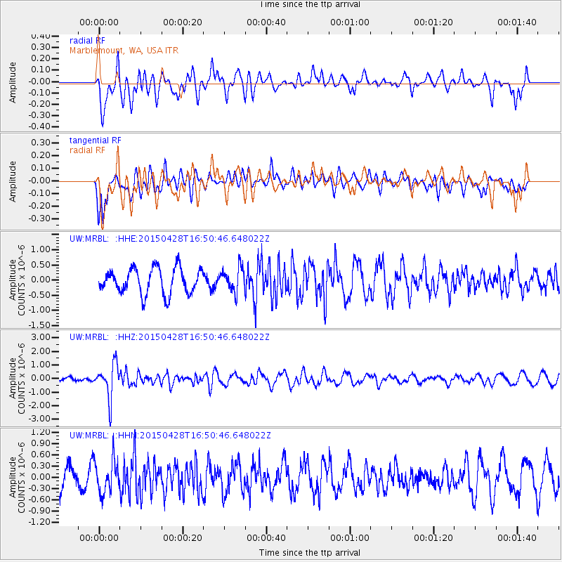
MRBL Marblemount, WA, USA - Earthquake Result Viewer
*The percent match for this event was below the threshold and hence no stack was calculated.
| Earthquake location: |
Fiji Islands Region |
| Earthquake latitude/longitude: |
-20.9/-178.7 |
| Earthquake time(UTC): |
2015/04/28 (118) 16:39:38 GMT |
| Earthquake Depth: |
579 km |
| Earthquake Magnitude: |
6.2 MWB |
| Earthquake Catalog/Contributor: |
NEIC PDE/NEIC COMCAT |
|
| Network: |
UW Pacific Northwest Regional Seismic Network |
| Station: |
MRBL Marblemount, WA, USA |
| Lat/Lon: |
48.52 N/121.48 W |
| Elevation: |
75 m |
|
| Distance: |
85.9 deg |
| Az: |
34.066 deg |
| Baz: |
231.965 deg |
| Ray Param: |
$rayparam |
*The percent match for this event was below the threshold and hence was not used in the summary stack. |
|
| Radial Match: |
72.288155 % |
| Radial Bump: |
400 |
| Transverse Match: |
49.09543 % |
| Transverse Bump: |
400 |
| SOD ConfigId: |
7422571 |
| Insert Time: |
2019-04-18 13:57:01.736 +0000 |
| GWidth: |
2.5 |
| Max Bumps: |
400 |
| Tol: |
0.001 |
|
Signal To Noise
| Channel | StoN | STA | LTA |
| UW:MRBL: :HHZ:20150428T16:50:46.648022Z | 5.7664914 | 1.2795642E-6 | 2.218965E-7 |
| UW:MRBL: :HHN:20150428T16:50:46.648022Z | 1.6879972 | 4.236303E-7 | 2.5096622E-7 |
| UW:MRBL: :HHE:20150428T16:50:46.648022Z | 0.9469185 | 4.002355E-7 | 4.2267158E-7 |
| Arrivals |
| Ps | |
| PpPs | |
| PsPs/PpSs | |


