You are here: Home > Network List > UW - Pacific Northwest Regional Seismic Network Stations List
> Station PASS Maple Falls, WA, USA > Earthquake Result Viewer
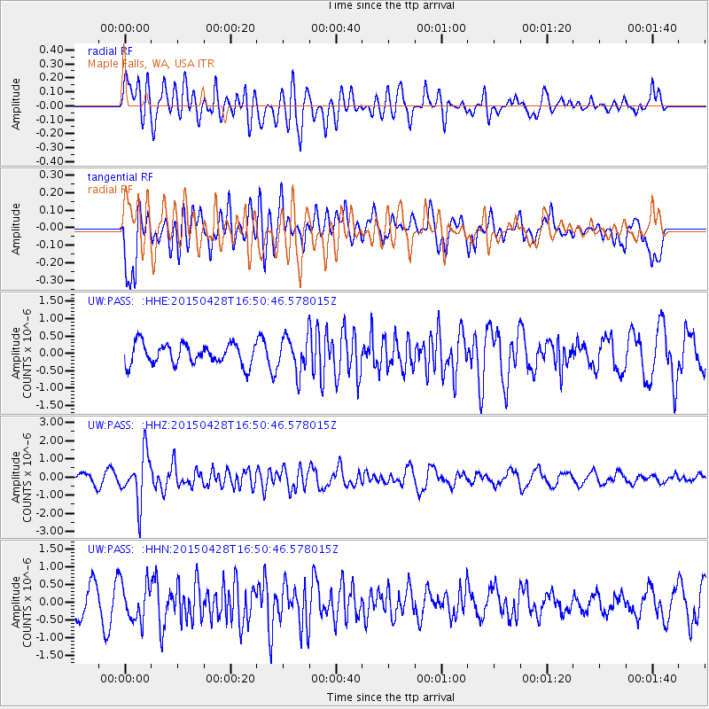
PASS Maple Falls, WA, USA - Earthquake Result Viewer
*The percent match for this event was below the threshold and hence no stack was calculated.
| Earthquake location: |
Fiji Islands Region |
| Earthquake latitude/longitude: |
-20.9/-178.7 |
| Earthquake time(UTC): |
2015/04/28 (118) 16:39:38 GMT |
| Earthquake Depth: |
579 km |
| Earthquake Magnitude: |
6.2 MWB |
| Earthquake Catalog/Contributor: |
NEIC PDE/NEIC COMCAT |
|
| Network: |
UW Pacific Northwest Regional Seismic Network |
| Station: |
PASS Maple Falls, WA, USA |
| Lat/Lon: |
49.00 N/122.09 W |
| Elevation: |
174 m |
|
| Distance: |
85.9 deg |
| Az: |
33.441 deg |
| Baz: |
231.469 deg |
| Ray Param: |
$rayparam |
*The percent match for this event was below the threshold and hence was not used in the summary stack. |
|
| Radial Match: |
62.851013 % |
| Radial Bump: |
400 |
| Transverse Match: |
69.88387 % |
| Transverse Bump: |
400 |
| SOD ConfigId: |
7422571 |
| Insert Time: |
2019-04-18 13:57:01.787 +0000 |
| GWidth: |
2.5 |
| Max Bumps: |
400 |
| Tol: |
0.001 |
|
Signal To Noise
| Channel | StoN | STA | LTA |
| UW:PASS: :HHZ:20150428T16:50:46.578015Z | 4.300072 | 1.3492083E-6 | 3.137641E-7 |
| UW:PASS: :HHN:20150428T16:50:46.578015Z | 1.3648959 | 5.17436E-7 | 3.7910286E-7 |
| UW:PASS: :HHE:20150428T16:50:46.578015Z | 1.8053384 | 5.380242E-7 | 2.9801848E-7 |
| Arrivals |
| Ps | |
| PpPs | |
| PsPs/PpSs | |


