You are here: Home > Network List > TA - USArray Transportable Network (new EarthScope stations) Stations List
> Station WHTX Lake Whitney, Meridian, TX, USA > Earthquake Result Viewer
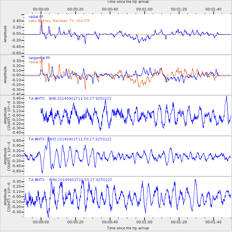
WHTX Lake Whitney, Meridian, TX, USA - Earthquake Result Viewer
*The percent match for this event was below the threshold and hence no stack was calculated.
| Earthquake location: |
Iceland |
| Earthquake latitude/longitude: |
64.7/-17.5 |
| Earthquake time(UTC): |
2014/09/01 (244) 11:41:10 GMT |
| Earthquake Depth: |
10 km |
| Earthquake Magnitude: |
5.5 MWW, 5.5 MWC |
| Earthquake Catalog/Contributor: |
NEIC PDE/NEIC COMCAT |
|
| Network: |
TA USArray Transportable Network (new EarthScope stations) |
| Station: |
WHTX Lake Whitney, Meridian, TX, USA |
| Lat/Lon: |
31.99 N/97.46 W |
| Elevation: |
190 m |
|
| Distance: |
57.3 deg |
| Az: |
276.351 deg |
| Baz: |
30.195 deg |
| Ray Param: |
$rayparam |
*The percent match for this event was below the threshold and hence was not used in the summary stack. |
|
| Radial Match: |
67.5661 % |
| Radial Bump: |
400 |
| Transverse Match: |
64.845436 % |
| Transverse Bump: |
400 |
| SOD ConfigId: |
796777 |
| Insert Time: |
2014-10-09 14:41:50.455 +0000 |
| GWidth: |
2.5 |
| Max Bumps: |
400 |
| Tol: |
0.001 |
|
Signal To Noise
| Channel | StoN | STA | LTA |
| TA:WHTX: :BHZ:20140901T11:50:27.925012Z | 4.146988 | 4.228471E-7 | 1.0196488E-7 |
| TA:WHTX: :BHN:20140901T11:50:27.925012Z | 1.7046705 | 2.1805616E-7 | 1.2791689E-7 |
| TA:WHTX: :BHE:20140901T11:50:27.925012Z | 1.5293784 | 1.622336E-7 | 1.0607813E-7 |
| Arrivals |
| Ps | |
| PpPs | |
| PsPs/PpSs | |


