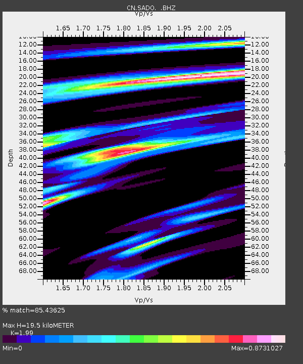
SADO SADOWA, ON - Earthquake Result Viewer
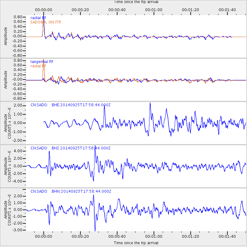
Earthquake location: Southern Alaska
Earthquake latitude/longitude: 62.0/-151.8
Earthquake time(UTC): 2014/09/25 (268) 17:51:17 GMT
Earthquake Depth: 103 km
Earthquake Magnitude: 6.2 ML, 6.1 MI, 6.2 MWW, 6.3 MWR, 6.3 MWB, 6.3 MWC
Earthquake Catalog/Contributor: NEIC PDE/NEIC COMCAT
Network: CN Canadian National Seismograph Network
Station: SADO SADOWA, ON
Lat/Lon: 44.77 N/79.14 W
Elevation: 243 m
Distance: 44.0 deg
Az: 78.002 deg
Baz: 319.528 deg
Ray Param: 0.07182382
Estimated Moho Depth: 19.5 km
Estimated Crust Vp/Vs: 1.99
Assumed Crust Vp: 6.577 km/s
Estimated Crust Vs: 3.305 km/s
Estimated Crust Poisson's Ratio: 0.33
Radial Match: 85.43625 %
Radial Bump: 262
Transverse Match: 58.9355 %
Transverse Bump: 347
SOD ConfigId: 796777
Insert Time: 2014-10-09 18:01:09.004 +0000
GWidth: 2.5
Max Bumps: 400
Tol: 0.001

Signal To Noise

ChannelStoNSTALTA
CN:SADO: :BHZ:20140925T17:58:44.000Z4.2662581.3734048E-63.2192258E-7
CN:SADO: :BHN:20140925T17:58:44.000Z2.4286847.2889617E-73.0011978E-7
CN:SADO: :BHE:20140925T17:58:44.000Z2.99051386.8485775E-72.2901006E-7
Arrivals
Ps3.1 SECOND
PpPs8.3 SECOND
PsPs/PpSs11 SECOND