ULM LAC DU BONNET, MB - Earthquake Result Viewer
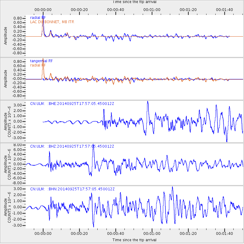
Earthquake location: Southern Alaska
Earthquake latitude/longitude: 62.0/-151.8
Earthquake time(UTC): 2014/09/25 (268) 17:51:17 GMT
Earthquake Depth: 103 km
Earthquake Magnitude: 6.2 ML, 6.1 MI, 6.2 MWW, 6.3 MWR, 6.3 MWB, 6.3 MWC
Earthquake Catalog/Contributor: NEIC PDE/NEIC COMCAT
Network: CN Canadian National Seismograph Network
Station: ULM LAC DU BONNET, MB
Lat/Lon: 50.25 N/95.88 W
Elevation: 251 m
Distance: 32.2 deg
Az: 85.128 deg
Baz: 312.81 deg
Ray Param: 0.07846141
Estimated Moho Depth: 34.75 km
Estimated Crust Vp/Vs: 1.77
Assumed Crust Vp: 6.459 km/s
Estimated Crust Vs: 3.649 km/s
Estimated Crust Poisson's Ratio: 0.27
Radial Match: 91.25694 %
Radial Bump: 299
Transverse Match: 73.899 %
Transverse Bump: 400
SOD ConfigId: 796777
Insert Time: 2014-10-09 18:01:15.545 +0000
GWidth: 2.5
Max Bumps: 400
Tol: 0.001

Signal To Noise

ChannelStoNSTALTA
CN:ULM: :BHZ:20140925T17:57:05.450012Z7.46684171.5414578E-62.064404E-7
CN:ULM: :BHN:20140925T17:57:05.450012Z4.2611916.7317467E-71.5797806E-7
CN:ULM: :BHE:20140925T17:57:05.450012Z4.2614916.902797E-71.619808E-7
Arrivals
Ps4.5 SECOND
PpPs14 SECOND
PsPs/PpSs18 SECOND