You are here: Home > Network List > TA - USArray Transportable Network (new EarthScope stations) Stations List
> Station H63A New Sharon, ME, USA > Earthquake Result Viewer
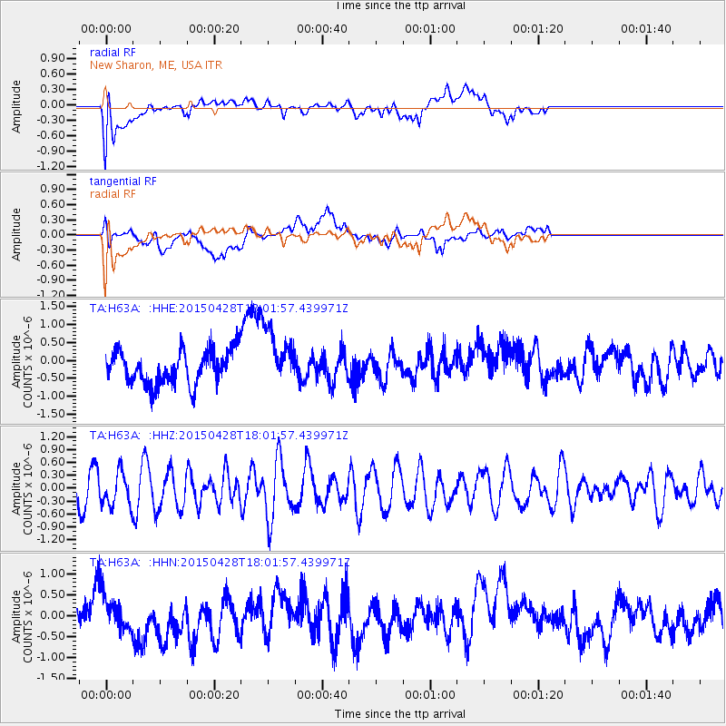
H63A New Sharon, ME, USA - Earthquake Result Viewer
*The percent match for this event was below the threshold and hence no stack was calculated.
| Earthquake location: |
Hokkaido, Japan Region |
| Earthquake latitude/longitude: |
43.2/145.9 |
| Earthquake time(UTC): |
2015/04/28 (118) 17:49:49 GMT |
| Earthquake Depth: |
51 km |
| Earthquake Magnitude: |
4.5 mb, 4.3 mb |
| Earthquake Catalog/Contributor: |
ISC/ISC |
|
| Network: |
TA USArray Transportable Network (new EarthScope stations) |
| Station: |
H63A New Sharon, ME, USA |
| Lat/Lon: |
44.66 N/70.04 W |
| Elevation: |
109 m |
|
| Distance: |
86.8 deg |
| Az: |
24.817 deg |
| Baz: |
334.525 deg |
| Ray Param: |
$rayparam |
*The percent match for this event was below the threshold and hence was not used in the summary stack. |
|
| Radial Match: |
45.37101 % |
| Radial Bump: |
400 |
| Transverse Match: |
35.99115 % |
| Transverse Bump: |
400 |
| SOD ConfigId: |
7422571 |
| Insert Time: |
2019-04-18 14:04:14.874 +0000 |
| GWidth: |
2.5 |
| Max Bumps: |
400 |
| Tol: |
0.001 |
|
Signal To Noise
| Channel | StoN | STA | LTA |
| TA:H63A: :HHZ:20150428T18:01:57.439971Z | 1.2589383 | 3.8857414E-7 | 3.0865223E-7 |
| TA:H63A: :HHN:20150428T18:01:57.439971Z | 0.6136795 | 4.200273E-7 | 6.844408E-7 |
| TA:H63A: :HHE:20150428T18:01:57.439971Z | 1.6924952 | 7.8785325E-7 | 4.6549806E-7 |
| Arrivals |
| Ps | |
| PpPs | |
| PsPs/PpSs | |


