
LUPA Lehigh University, PA - Earthquake Result Viewer
| ||||||||||||||||||
| ||||||||||||||||||
| ||||||||||||||||||
|
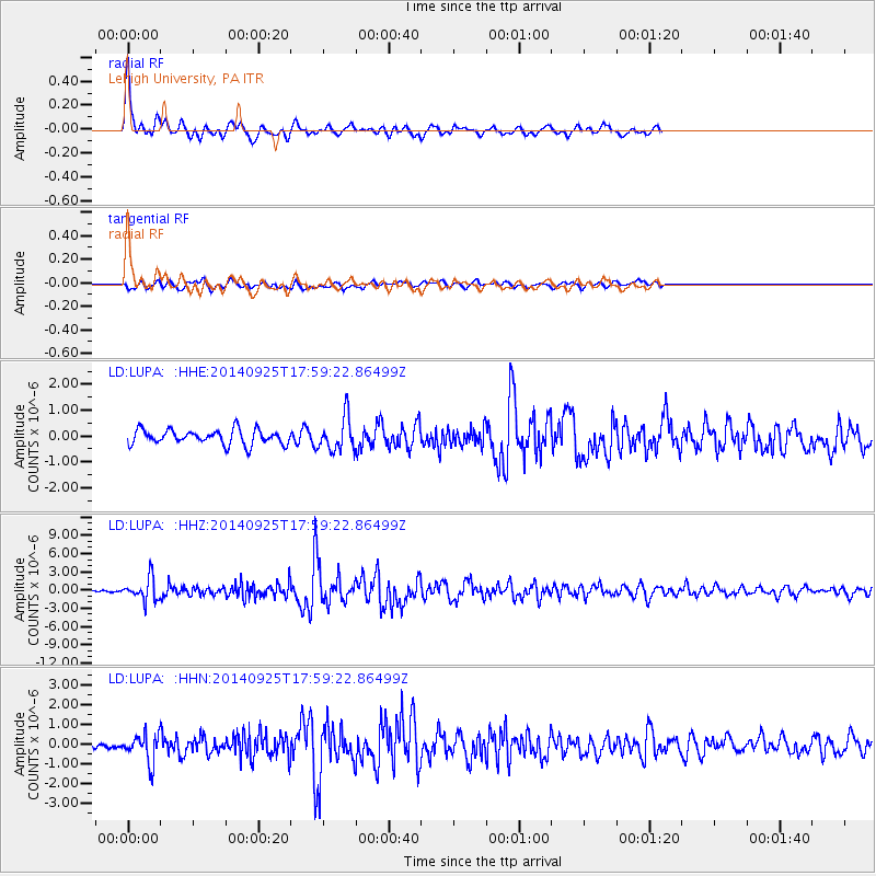
Signal To Noise
| Channel | StoN | STA | LTA |
| LD:LUPA: :HHZ:20140925T17:59:22.86499Z | 4.9412813 | 1.8687567E-6 | 3.7819274E-7 |
| LD:LUPA: :HHN:20140925T17:59:22.86499Z | 2.70196 | 7.032196E-7 | 2.6026277E-7 |
| LD:LUPA: :HHE:20140925T17:59:22.86499Z | 2.246103 | 6.43737E-7 | 2.8660173E-7 |
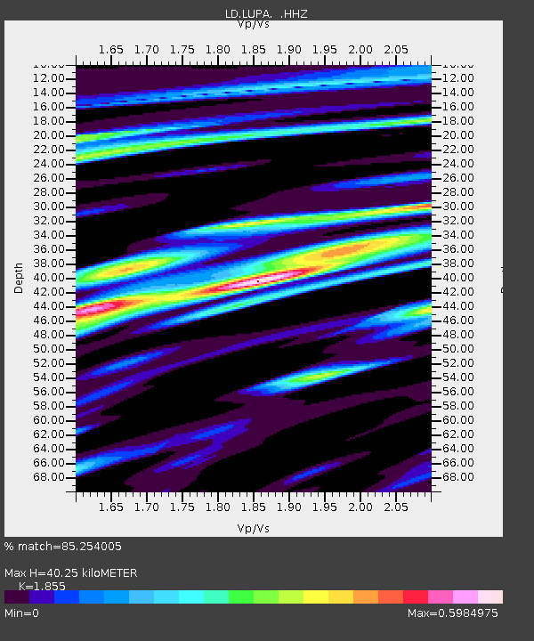
| Arrivals | |
| Ps | 5.8 SECOND |
| PpPs | 17 SECOND |
| PsPs/PpSs | 23 SECOND |

