
MVL Millersville University, PA - Earthquake Result Viewer
| ||||||||||||||||||
| ||||||||||||||||||
| ||||||||||||||||||
|
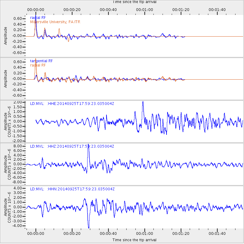
Signal To Noise
| Channel | StoN | STA | LTA |
| LD:MVL: :HHZ:20140925T17:59:23.035004Z | 4.2813716 | 1.0762595E-6 | 2.5138195E-7 |
| LD:MVL: :HHN:20140925T17:59:23.035004Z | 3.9960694 | 6.833683E-7 | 1.7101011E-7 |
| LD:MVL: :HHE:20140925T17:59:23.035004Z | 2.7110903 | 4.1267464E-7 | 1.5221721E-7 |
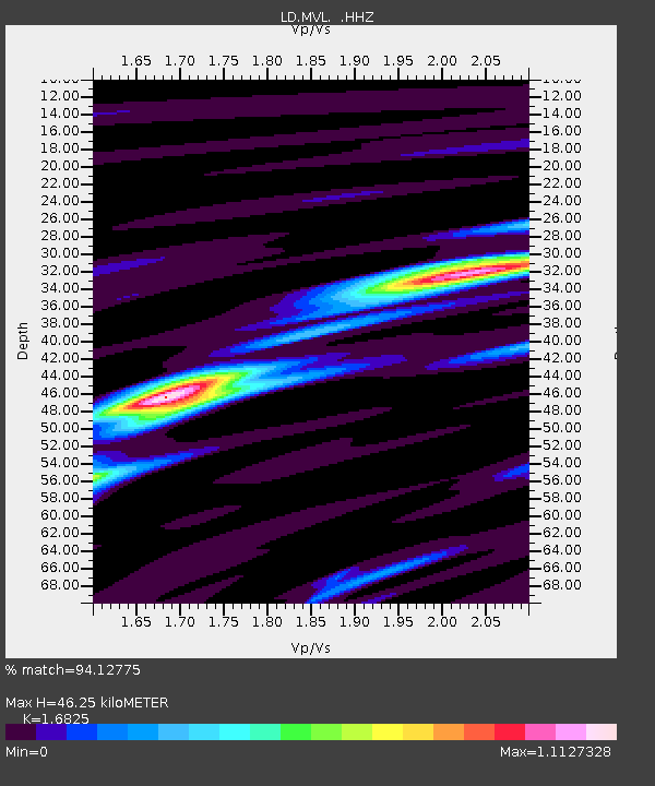
| Arrivals | |
| Ps | 5.2 SECOND |
| PpPs | 18 SECOND |
| PsPs/PpSs | 23 SECOND |

