WUPA West Chester University of Pennsylvania - Earthquake Result Viewer
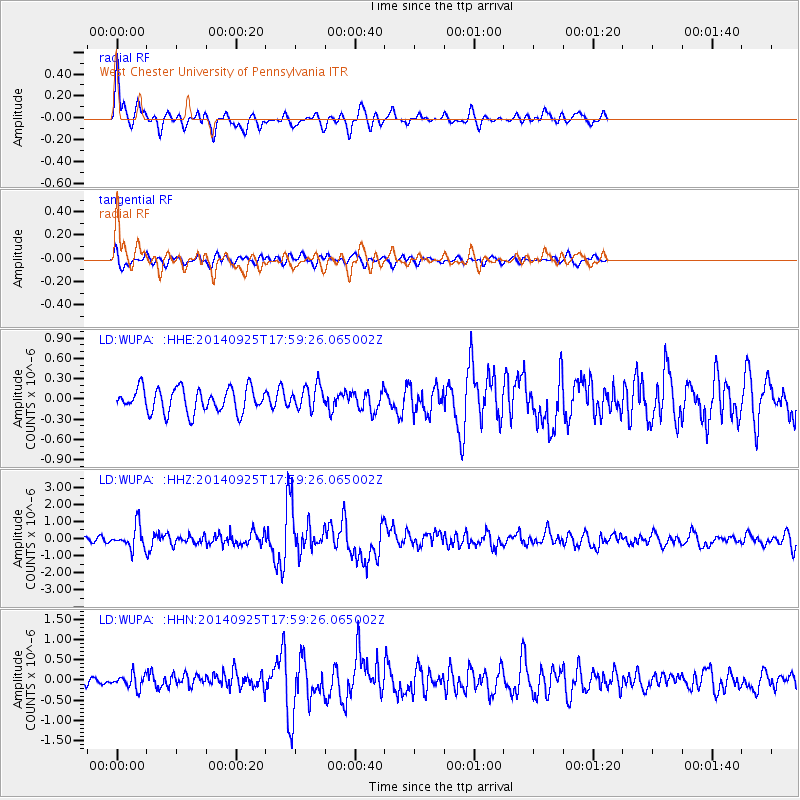
Earthquake location: Southern Alaska
Earthquake latitude/longitude: 62.0/-151.8
Earthquake time(UTC): 2014/09/25 (268) 17:51:17 GMT
Earthquake Depth: 103 km
Earthquake Magnitude: 6.2 ML, 6.1 MI, 6.2 MWW, 6.3 MWR, 6.3 MWB, 6.3 MWC
Earthquake Catalog/Contributor: NEIC PDE/NEIC COMCAT
Network: LD Lamont-Doherty Cooperative Seismographic Network
Station: WUPA West Chester University of Pennsylvania
Lat/Lon: 39.93 N/75.61 W
Elevation: 86 m
Distance: 49.4 deg
Az: 79.356 deg
Baz: 322.833 deg
Ray Param: 0.06836912
Estimated Moho Depth: 31.0 km
Estimated Crust Vp/Vs: 1.72
Assumed Crust Vp: 6.287 km/s
Estimated Crust Vs: 3.661 km/s
Estimated Crust Poisson's Ratio: 0.24
Radial Match: 90.58327 %
Radial Bump: 400
Transverse Match: 73.64326 %
Transverse Bump: 400
SOD ConfigId: 796777
Insert Time: 2014-10-09 18:12:13.502 +0000
GWidth: 2.5
Max Bumps: 400
Tol: 0.001

Signal To Noise

ChannelStoNSTALTA
LD:WUPA: :HHZ:20140925T17:59:26.065002Z4.0331196.545759E-71.6230015E-7
LD:WUPA: :HHN:20140925T17:59:26.065002Z1.47996431.7023218E-71.1502452E-7
LD:WUPA: :HHE:20140925T17:59:26.065002Z0.982758051.7388228E-71.7693296E-7
Arrivals
Ps3.7 SECOND
PpPs13 SECOND
PsPs/PpSs16 SECOND