You are here: Home > Network List > TA - USArray Transportable Network (new EarthScope stations) Stations List
> Station I61A Oroboro, Fairlee, VT, USA > Earthquake Result Viewer
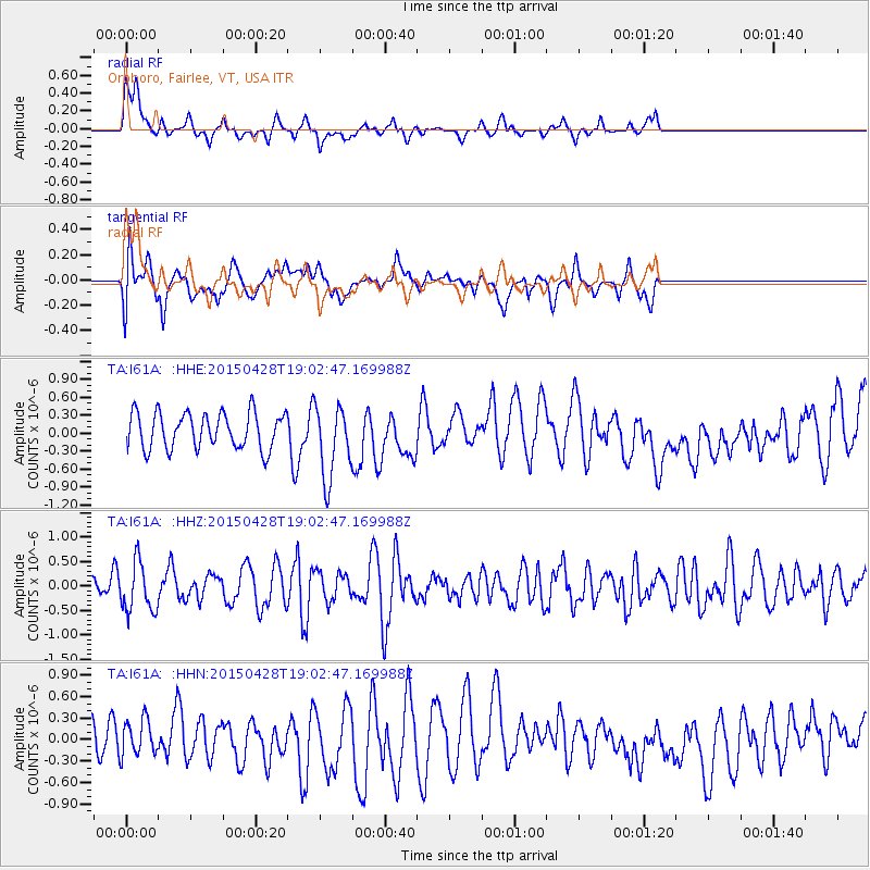
I61A Oroboro, Fairlee, VT, USA - Earthquake Result Viewer
*The percent match for this event was below the threshold and hence no stack was calculated.
| Earthquake location: |
Chiapas, Mexico |
| Earthquake latitude/longitude: |
17.2/-95.0 |
| Earthquake time(UTC): |
2015/04/28 (118) 18:56:53 GMT |
| Earthquake Depth: |
110 km |
| Earthquake Magnitude: |
5.5 MWR |
| Earthquake Catalog/Contributor: |
NEIC PDE/NEIC COMCAT |
|
| Network: |
TA USArray Transportable Network (new EarthScope stations) |
| Station: |
I61A Oroboro, Fairlee, VT, USA |
| Lat/Lon: |
43.93 N/72.21 W |
| Elevation: |
287 m |
|
| Distance: |
32.9 deg |
| Az: |
30.967 deg |
| Baz: |
222.915 deg |
| Ray Param: |
$rayparam |
*The percent match for this event was below the threshold and hence was not used in the summary stack. |
|
| Radial Match: |
45.413486 % |
| Radial Bump: |
381 |
| Transverse Match: |
39.834263 % |
| Transverse Bump: |
400 |
| SOD ConfigId: |
7422571 |
| Insert Time: |
2019-04-18 14:10:22.467 +0000 |
| GWidth: |
2.5 |
| Max Bumps: |
400 |
| Tol: |
0.001 |
|
Signal To Noise
| Channel | StoN | STA | LTA |
| TA:I61A: :HHZ:20150428T19:02:47.169988Z | 1.6224052 | 5.0125567E-7 | 3.0895836E-7 |
| TA:I61A: :HHN:20150428T19:02:47.169988Z | 1.2794138 | 2.4813926E-7 | 1.9394761E-7 |
| TA:I61A: :HHE:20150428T19:02:47.169988Z | 2.0621552 | 6.168001E-7 | 2.9910456E-7 |
| Arrivals |
| Ps | |
| PpPs | |
| PsPs/PpSs | |


