
PAGS PA Geological Survey - Earthquake Result Viewer
| ||||||||||||||||||
| ||||||||||||||||||
| ||||||||||||||||||
|
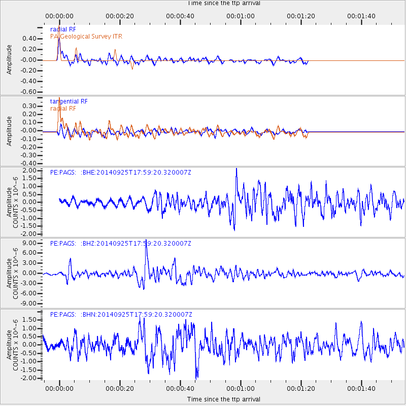
Signal To Noise
| Channel | StoN | STA | LTA |
| PE:PAGS: :BHZ:20140925T17:59:20.320007Z | 5.8435597 | 1.6619921E-6 | 2.8441434E-7 |
| PE:PAGS: :BHN:20140925T17:59:20.320007Z | 1.2045625 | 2.9257586E-7 | 2.4288974E-7 |
| PE:PAGS: :BHE:20140925T17:59:20.320007Z | 2.782739 | 4.876056E-7 | 1.7522507E-7 |
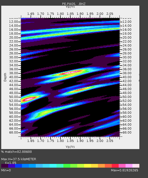
| Arrivals | |
| Ps | 5.5 SECOND |
| PpPs | 17 SECOND |
| PsPs/PpSs | 22 SECOND |

