
WRPS We R Penn State - Earthquake Result Viewer
| ||||||||||||||||||
| ||||||||||||||||||
| ||||||||||||||||||
|
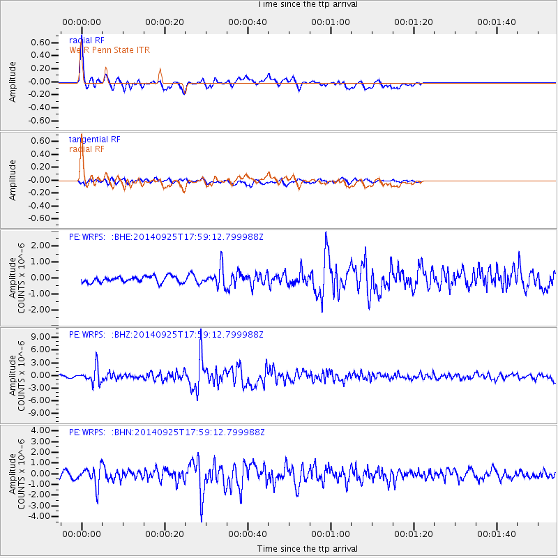
Signal To Noise
| Channel | StoN | STA | LTA |
| PE:WRPS: :BHZ:20140925T17:59:12.799988Z | 10.644397 | 1.9575484E-6 | 1.8390413E-7 |
| PE:WRPS: :BHN:20140925T17:59:12.799988Z | 3.616233 | 9.042357E-7 | 2.5004906E-7 |
| PE:WRPS: :BHE:20140925T17:59:12.799988Z | 3.1723826 | 6.059611E-7 | 1.9101134E-7 |
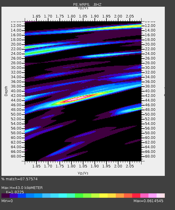
| Arrivals | |
| Ps | 6.1 SECOND |
| PpPs | 19 SECOND |
| PsPs/PpSs | 25 SECOND |

