You are here: Home > Network List > IU - Global Seismograph Network (GSN - IRIS/USGS) Stations List
> Station DAV Davao, Philippines > Earthquake Result Viewer
DAV Davao, Philippines - Earthquake Result Viewer

| Earthquake location: |
Kuril Islands |
| Earthquake latitude/longitude: |
44.5/149.1 |
| Earthquake time(UTC): |
1995/11/24 (328) 17:24:12 GMT |
| Earthquake Depth: |
33 km |
| Earthquake Magnitude: |
6.1 MB, 6.3 MS, 6.1 UNKNOWN, 6.6 MW |
| Earthquake Catalog/Contributor: |
WHDF/NEIC |
|
| Network: |
IU Global Seismograph Network (GSN - IRIS/USGS) |
| Station: |
DAV Davao, Philippines |
| Lat/Lon: |
7.07 N/125.58 E |
| Elevation: |
150 m |
|
| Distance: |
42.6 deg |
| Az: |
215.812 deg |
| Baz: |
24.934 deg |
| Ray Param: |
0.073025696 |
| Estimated Moho Depth: |
52.25 km |
| Estimated Crust Vp/Vs: |
2.05 |
| Assumed Crust Vp: |
6.468 km/s |
| Estimated Crust Vs: |
3.159 km/s |
| Estimated Crust Poisson's Ratio: |
0.34 |
|
| Radial Match: |
81.044975 % |
| Radial Bump: |
400 |
| Transverse Match: |
80.970856 % |
| Transverse Bump: |
400 |
| SOD ConfigId: |
4480 |
| Insert Time: |
2010-03-02 01:56:00.849 +0000 |
| GWidth: |
2.5 |
| Max Bumps: |
400 |
| Tol: |
0.001 |
|
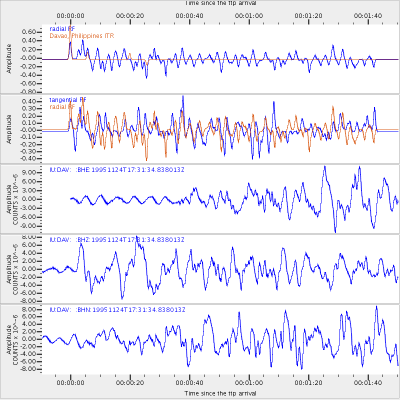
Signal To Noise
| Channel | StoN | STA | LTA |
| IU:DAV: :BHZ:19951124T17:31:34.838013Z | 9.781615 | 3.009976E-6 | 3.077177E-7 |
| IU:DAV: :BHN:19951124T17:31:34.838013Z | 1.7200235 | 1.2912196E-6 | 7.506988E-7 |
| IU:DAV: :BHE:19951124T17:31:34.838013Z | 1.0252445 | 8.70482E-7 | 8.490482E-7 |
| Arrivals |
| Ps | 9.0 SECOND |
| PpPs | 23 SECOND |
| PsPs/PpSs | 32 SECOND |


