You are here: Home > Network List > UW - Pacific Northwest Regional Seismic Network Stations List
> Station MRBL Marblemount, WA, USA > Earthquake Result Viewer
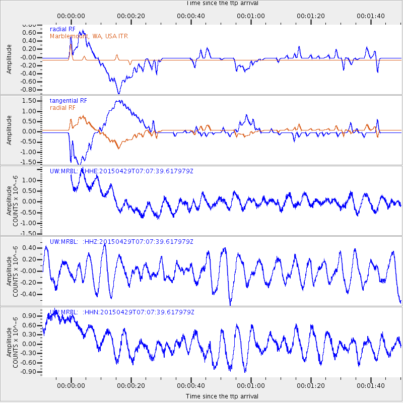
MRBL Marblemount, WA, USA - Earthquake Result Viewer
*The percent match for this event was below the threshold and hence no stack was calculated.
| Earthquake location: |
Kermadec Islands Region |
| Earthquake latitude/longitude: |
-31.5/-177.0 |
| Earthquake time(UTC): |
2015/04/29 (119) 06:54:57 GMT |
| Earthquake Depth: |
35 km |
| Earthquake Magnitude: |
4.9 MW, 5.0 mb |
| Earthquake Catalog/Contributor: |
ISC/ISC |
|
| Network: |
UW Pacific Northwest Regional Seismic Network |
| Station: |
MRBL Marblemount, WA, USA |
| Lat/Lon: |
48.52 N/121.48 W |
| Elevation: |
75 m |
|
| Distance: |
93.8 deg |
| Az: |
33.314 deg |
| Baz: |
224.894 deg |
| Ray Param: |
$rayparam |
*The percent match for this event was below the threshold and hence was not used in the summary stack. |
|
| Radial Match: |
27.978922 % |
| Radial Bump: |
400 |
| Transverse Match: |
21.934372 % |
| Transverse Bump: |
400 |
| SOD ConfigId: |
7422571 |
| Insert Time: |
2019-04-18 14:20:15.311 +0000 |
| GWidth: |
2.5 |
| Max Bumps: |
400 |
| Tol: |
0.001 |
|
Signal To Noise
| Channel | StoN | STA | LTA |
| UW:MRBL: :HHZ:20150429T07:07:39.617979Z | 0.36009046 | 9.886592E-8 | 2.7455854E-7 |
| UW:MRBL: :HHN:20150429T07:07:39.617979Z | 1.1710308 | 1.6041166E-6 | 1.3698331E-6 |
| UW:MRBL: :HHE:20150429T07:07:39.617979Z | 1.1572553 | 6.969889E-7 | 6.0227757E-7 |
| Arrivals |
| Ps | |
| PpPs | |
| PsPs/PpSs | |


