You are here: Home > Network List > US - United States National Seismic Network Stations List
> Station WMOK Wichita Mountains, Oklahoma, USA > Earthquake Result Viewer
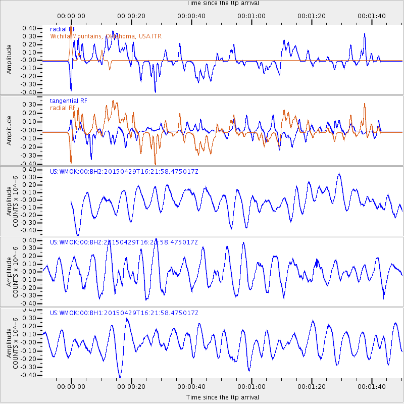
WMOK Wichita Mountains, Oklahoma, USA - Earthquake Result Viewer
*The percent match for this event was below the threshold and hence no stack was calculated.
| Earthquake location: |
Near East Coast Of Honshu, Japan |
| Earthquake latitude/longitude: |
40.1/142.9 |
| Earthquake time(UTC): |
2015/04/29 (119) 16:09:51 GMT |
| Earthquake Depth: |
34 km |
| Earthquake Magnitude: |
5.4 MW, 5.3 mb, 5.3 MS |
| Earthquake Catalog/Contributor: |
ISC/ISC |
|
| Network: |
US United States National Seismic Network |
| Station: |
WMOK Wichita Mountains, Oklahoma, USA |
| Lat/Lon: |
34.74 N/98.78 W |
| Elevation: |
486 m |
|
| Distance: |
86.3 deg |
| Az: |
46.584 deg |
| Baz: |
317.404 deg |
| Ray Param: |
$rayparam |
*The percent match for this event was below the threshold and hence was not used in the summary stack. |
|
| Radial Match: |
39.57696 % |
| Radial Bump: |
400 |
| Transverse Match: |
59.55973 % |
| Transverse Bump: |
400 |
| SOD ConfigId: |
7422571 |
| Insert Time: |
2019-04-18 14:28:25.400 +0000 |
| GWidth: |
2.5 |
| Max Bumps: |
400 |
| Tol: |
0.001 |
|
Signal To Noise
| Channel | StoN | STA | LTA |
| US:WMOK:00:BHZ:20150429T16:21:58.475017Z | 1.5305797 | 1.2858504E-7 | 8.4010686E-8 |
| US:WMOK:00:BH1:20150429T16:21:58.475017Z | 0.84013116 | 8.2573344E-8 | 9.828625E-8 |
| US:WMOK:00:BH2:20150429T16:21:58.475017Z | 0.98325 | 1.4974361E-7 | 1.5229455E-7 |
| Arrivals |
| Ps | |
| PpPs | |
| PsPs/PpSs | |


