You are here: Home > Network List > IU - Global Seismograph Network (GSN - IRIS/USGS) Stations List
> Station DAV Davao, Philippines > Earthquake Result Viewer
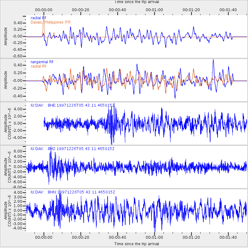
DAV Davao, Philippines - Earthquake Result Viewer
*The percent match for this event was below the threshold and hence no stack was calculated.
| Earthquake location: |
South Of Fiji Islands |
| Earthquake latitude/longitude: |
-22.3/-179.7 |
| Earthquake time(UTC): |
1997/12/26 (360) 05:34:24 GMT |
| Earthquake Depth: |
588 km |
| Earthquake Magnitude: |
5.9 UNKNOWN, 5.3 MB, 5.8 MW |
| Earthquake Catalog/Contributor: |
WHDF/NEIC |
|
| Network: |
IU Global Seismograph Network (GSN - IRIS/USGS) |
| Station: |
DAV Davao, Philippines |
| Lat/Lon: |
7.07 N/125.58 E |
| Elevation: |
145 m |
|
| Distance: |
61.0 deg |
| Az: |
292.144 deg |
| Baz: |
120.227 deg |
| Ray Param: |
$rayparam |
*The percent match for this event was below the threshold and hence was not used in the summary stack. |
|
| Radial Match: |
63.347744 % |
| Radial Bump: |
400 |
| Transverse Match: |
65.90988 % |
| Transverse Bump: |
400 |
| SOD ConfigId: |
4480 |
| Insert Time: |
2010-03-02 01:56:44.239 +0000 |
| GWidth: |
2.5 |
| Max Bumps: |
400 |
| Tol: |
0.001 |
|
Signal To Noise
| Channel | StoN | STA | LTA |
| IU:DAV: :BHZ:19971226T05:43:11.465015Z | 2.875191 | 2.6158343E-6 | 9.0979506E-7 |
| IU:DAV: :BHN:19971226T05:43:11.465015Z | 1.2650195 | 1.0227144E-6 | 8.084574E-7 |
| IU:DAV: :BHE:19971226T05:43:11.465015Z | 1.2815272 | 1.1069905E-6 | 8.6380567E-7 |
| Arrivals |
| Ps | |
| PpPs | |
| PsPs/PpSs | |


