You are here: Home > Network List > TA - USArray Transportable Network (new EarthScope stations) Stations List
> Station MDND Maddock, ND, USA > Earthquake Result Viewer
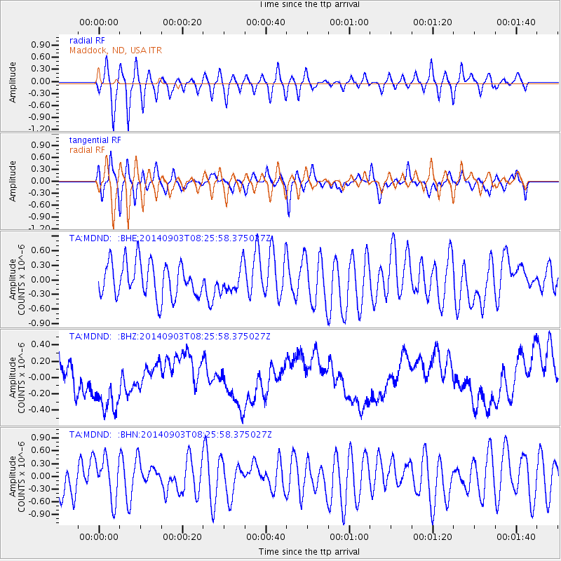
MDND Maddock, ND, USA - Earthquake Result Viewer
*The percent match for this event was below the threshold and hence no stack was calculated.
| Earthquake location: |
Tonga Islands |
| Earthquake latitude/longitude: |
-15.0/-173.5 |
| Earthquake time(UTC): |
2014/09/03 (246) 08:13:27 GMT |
| Earthquake Depth: |
10 km |
| Earthquake Magnitude: |
5.5 MWC, 5.5 MWC |
| Earthquake Catalog/Contributor: |
NEIC PDE/NEIC COMCAT |
|
| Network: |
TA USArray Transportable Network (new EarthScope stations) |
| Station: |
MDND Maddock, ND, USA |
| Lat/Lon: |
47.85 N/99.60 W |
| Elevation: |
479 m |
|
| Distance: |
90.6 deg |
| Az: |
40.334 deg |
| Baz: |
248.2 deg |
| Ray Param: |
$rayparam |
*The percent match for this event was below the threshold and hence was not used in the summary stack. |
|
| Radial Match: |
71.85778 % |
| Radial Bump: |
400 |
| Transverse Match: |
49.14986 % |
| Transverse Bump: |
400 |
| SOD ConfigId: |
796777 |
| Insert Time: |
2014-10-14 10:12:24.435 +0000 |
| GWidth: |
2.5 |
| Max Bumps: |
400 |
| Tol: |
0.001 |
|
Signal To Noise
| Channel | StoN | STA | LTA |
| TA:MDND: :BHZ:20140903T08:25:58.375027Z | 2.4233825 | 3.8398628E-7 | 1.5845055E-7 |
| TA:MDND: :BHN:20140903T08:25:58.375027Z | 1.3345168 | 4.952929E-7 | 3.711403E-7 |
| TA:MDND: :BHE:20140903T08:25:58.375027Z | 0.7692283 | 2.726311E-7 | 3.544216E-7 |
| Arrivals |
| Ps | |
| PpPs | |
| PsPs/PpSs | |


