You are here: Home > Network List > TA - USArray Transportable Network (new EarthScope stations) Stations List
> Station W41B Gary Mavity, Velonia, AR, USA > Earthquake Result Viewer
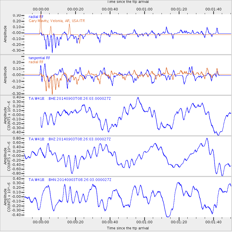
W41B Gary Mavity, Velonia, AR, USA - Earthquake Result Viewer
*The percent match for this event was below the threshold and hence no stack was calculated.
| Earthquake location: |
Tonga Islands |
| Earthquake latitude/longitude: |
-15.0/-173.5 |
| Earthquake time(UTC): |
2014/09/03 (246) 08:13:27 GMT |
| Earthquake Depth: |
10 km |
| Earthquake Magnitude: |
5.5 MWC, 5.5 MWC |
| Earthquake Catalog/Contributor: |
NEIC PDE/NEIC COMCAT |
|
| Network: |
TA USArray Transportable Network (new EarthScope stations) |
| Station: |
W41B Gary Mavity, Velonia, AR, USA |
| Lat/Lon: |
35.17 N/92.25 W |
| Elevation: |
95 m |
|
| Distance: |
91.6 deg |
| Az: |
54.101 deg |
| Baz: |
252.829 deg |
| Ray Param: |
$rayparam |
*The percent match for this event was below the threshold and hence was not used in the summary stack. |
|
| Radial Match: |
84.12084 % |
| Radial Bump: |
400 |
| Transverse Match: |
45.236958 % |
| Transverse Bump: |
400 |
| SOD ConfigId: |
796777 |
| Insert Time: |
2014-10-14 10:12:44.623 +0000 |
| GWidth: |
2.5 |
| Max Bumps: |
400 |
| Tol: |
0.001 |
|
Signal To Noise
| Channel | StoN | STA | LTA |
| TA:W41B: :BHZ:20140903T08:26:03.000027Z | 2.068379 | 3.5414476E-7 | 1.7121852E-7 |
| TA:W41B: :BHN:20140903T08:26:03.000027Z | 1.5466814 | 1.8642442E-7 | 1.2053188E-7 |
| TA:W41B: :BHE:20140903T08:26:03.000027Z | 0.8377679 | 9.477053E-8 | 1.1312265E-7 |
| Arrivals |
| Ps | |
| PpPs | |
| PsPs/PpSs | |


