You are here: Home > Network List > II - Global Seismograph Network (GSN - IRIS/IDA) Stations List
> Station WRAB Tennant Creek, NT, Australia > Earthquake Result Viewer
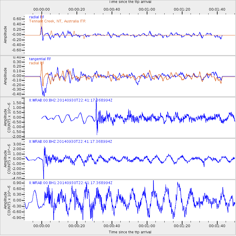
WRAB Tennant Creek, NT, Australia - Earthquake Result Viewer
*The percent match for this event was below the threshold and hence no stack was calculated.
| Earthquake location: |
Fiji Islands Region |
| Earthquake latitude/longitude: |
-17.8/-178.6 |
| Earthquake time(UTC): |
2014/09/30 (273) 22:34:27 GMT |
| Earthquake Depth: |
574 km |
| Earthquake Magnitude: |
5.5 MWP |
| Earthquake Catalog/Contributor: |
NEIC PDE/NEIC COMCAT |
|
| Network: |
II Global Seismograph Network (GSN - IRIS/IDA) |
| Station: |
WRAB Tennant Creek, NT, Australia |
| Lat/Lon: |
19.93 S/134.36 E |
| Elevation: |
366 m |
|
| Distance: |
44.5 deg |
| Az: |
259.478 deg |
| Baz: |
95.416 deg |
| Ray Param: |
$rayparam |
*The percent match for this event was below the threshold and hence was not used in the summary stack. |
|
| Radial Match: |
49.789455 % |
| Radial Bump: |
400 |
| Transverse Match: |
84.55403 % |
| Transverse Bump: |
400 |
| SOD ConfigId: |
796777 |
| Insert Time: |
2014-10-14 23:03:44.096 +0000 |
| GWidth: |
2.5 |
| Max Bumps: |
400 |
| Tol: |
0.001 |
|
Signal To Noise
| Channel | StoN | STA | LTA |
| II:WRAB:00:BHZ:20140930T22:41:17.368994Z | 5.7377057 | 1.1327515E-6 | 1.9742238E-7 |
| II:WRAB:00:BH1:20140930T22:41:17.368994Z | 1.4518211 | 3.1288667E-7 | 2.1551324E-7 |
| II:WRAB:00:BH2:20140930T22:41:17.368994Z | 2.5910625 | 6.5008726E-7 | 2.5089602E-7 |
| Arrivals |
| Ps | |
| PpPs | |
| PsPs/PpSs | |


